
Collection
Science
2026.09.11
Satellites Observing Earth's Changes Every Day
Earth observation spacecraft reading land, sea, atmosphere, and climate with different sensors
Earth observation satellites transform our familiar planet into unfamiliar data. By repeatedly measuring the colors of forests and cities, phytoplankton in the sea, and the ozone and moisture in the atmosphere, we can see changes that take longer than a single photo.
This list gathers actual satellites measuring land, water cycles, atmosphere, and oceans from Landsat 1 to PACE. By examining the intervals at which the sensors revisit the same locations, it's easier to discern how data on wildfires, agriculture, climate, and marine ecosystems are generated. By checking the actual mission data and spacecraft structures of satellites that record Earth's changes every day, we can more specifically understand the reasons behind these different choices.
This list gathers actual satellites measuring land, water cycles, atmosphere, and oceans from Landsat 1 to PACE. By examining the intervals at which the sensors revisit the same locations, it's easier to discern how data on wildfires, agriculture, climate, and marine ecosystems are generated. By checking the actual mission data and spacecraft structures of satellites that record Earth's changes every day, we can more specifically understand the reasons behind these different choices.
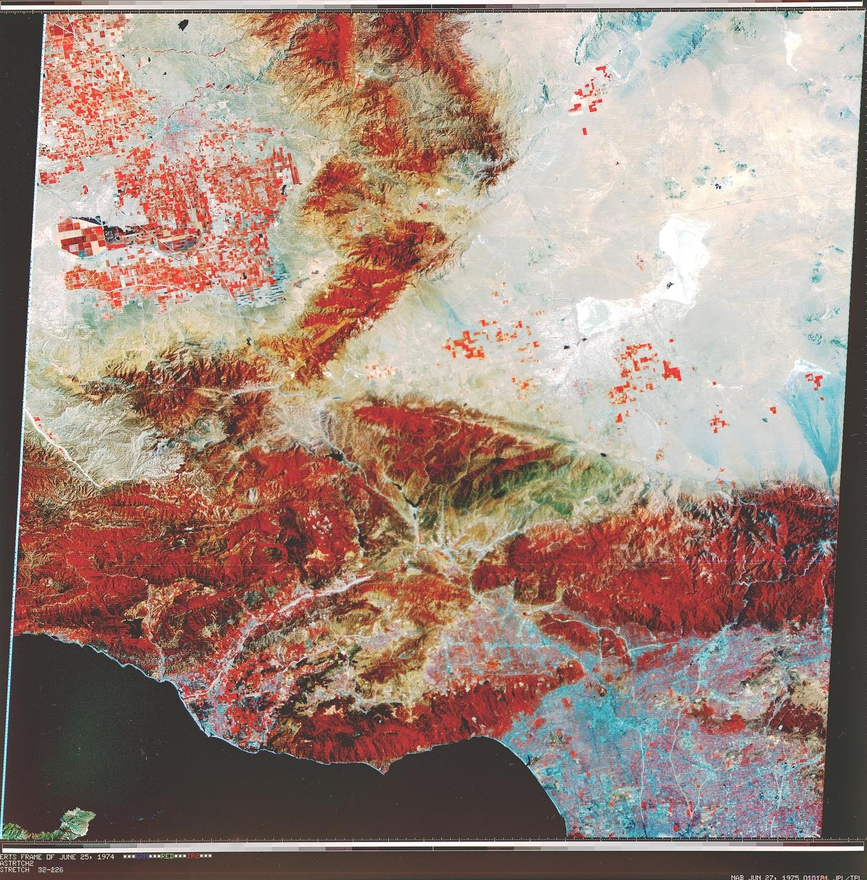
Landsat 1
When examining ‘Landsat 1’, its distinctive features can be found in the mission trajectory. This spacecraft is the first satellite from the Landsat program, which has been conducting long-term civilian Earth observation. It was launched by NASA and USGS on July 23, 1972, and aimed at Earth as a multispectral Earth observation satellite. By looking at these four pieces of information together, we can distinguish ‘Landsat 1’s historical position and actual mission range that isn’t revealed by the name alone.
What’s most interesting about ‘Landsat 1’ is that it marks the starting point of comparing land changes by recording the same surfaces across multiple wavelengths. When reading mission data from ‘Landsat 1’, it’s worth following not just the successful scenes but also the procedures that reduced risks. The mission status of ‘Landsat 1’ is ‘Mission Completed’, and for decommissioned spacecraft, we should read their data and follow-up technologies left behind, while for operational spacecraft, we should focus on tasks expanded from the original plan. This way, it becomes clear that ‘Landsat 1’ was not just a simple record holder but a tool that solved specific problems.
Following the flow of the list, it’s worth examining ‘Terra’. Comparing ‘Landsat 1’s multispectral Earth observation satellite with ‘Terra’s multisensor Earth observation satellite, we can confirm that the method of reading Earth changes through repeated observations was accumulated not from a single invention but from the trial and error of multiple missions. The official page for ‘Landsat 1’ provides more detailed information about its launch, mission progress, and payload, so for ongoing missions where dates and statuses change, it’s safer to check the latest notices together.
What’s most interesting about ‘Landsat 1’ is that it marks the starting point of comparing land changes by recording the same surfaces across multiple wavelengths. When reading mission data from ‘Landsat 1’, it’s worth following not just the successful scenes but also the procedures that reduced risks. The mission status of ‘Landsat 1’ is ‘Mission Completed’, and for decommissioned spacecraft, we should read their data and follow-up technologies left behind, while for operational spacecraft, we should focus on tasks expanded from the original plan. This way, it becomes clear that ‘Landsat 1’ was not just a simple record holder but a tool that solved specific problems.
Following the flow of the list, it’s worth examining ‘Terra’. Comparing ‘Landsat 1’s multispectral Earth observation satellite with ‘Terra’s multisensor Earth observation satellite, we can confirm that the method of reading Earth changes through repeated observations was accumulated not from a single invention but from the trial and error of multiple missions. The official page for ‘Landsat 1’ provides more detailed information about its launch, mission progress, and payload, so for ongoing missions where dates and statuses change, it’s safer to check the latest notices together.
운영기관 NASA·USGS
발사일 1972-07-23
형식 다중분광 지구관측위성
목표 지구
임무 상태 임무 종료
이미지 자료 NASA Image Library · Early Landsat View of Los Angeles and Vicinity
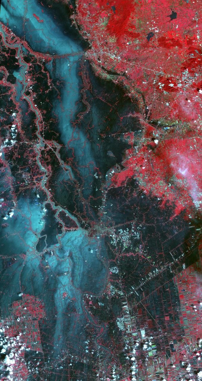
Terra
When examining ‘Terra’, its value lies in the criteria it left for the next missions rather than just the stunning records. This spacecraft is a satellite that long-term observes the interactions between land, atmosphere, and oceans using five sensors. Launched by NASA on December 18, 1999, it aimed at Earth as a multisensor Earth observation satellite. By looking at these four pieces of information together, we can distinguish ‘Terra’s historical position and actual mission range that isn’t revealed by the name alone.
What’s most interesting about ‘Terra’ is its configuration, which collects different Earth system data from a single platform. When looking at ‘Terra’, understanding the sequence in which equipment was used after reaching the target clarifies the design. The mission status of ‘Terra’ is ‘Operational Mission’, and for decommissioned spacecraft, we should read their data and follow-up technologies left behind, while for operational spacecraft, we should focus on tasks expanded from the original plan. This way, it becomes clear that ‘Terra’ was not just a simple record holder but a tool that solved specific problems.
Following the flow of the list, it’s worth examining ‘Aqua’. Comparing ‘Terra’s multisensor Earth observation satellite with ‘Aqua’s water cycle Earth observation satellite reassures us that the method of reading Earth changes through repeated observations was accumulated not from a single invention but from multiple missions’ trial and error. The official page for ‘Terra’ provides more detailed information about its launch, mission progress, and payload, so for ongoing missions where dates and statuses change, it’s safer to check the latest notices together.
What’s most interesting about ‘Terra’ is its configuration, which collects different Earth system data from a single platform. When looking at ‘Terra’, understanding the sequence in which equipment was used after reaching the target clarifies the design. The mission status of ‘Terra’ is ‘Operational Mission’, and for decommissioned spacecraft, we should read their data and follow-up technologies left behind, while for operational spacecraft, we should focus on tasks expanded from the original plan. This way, it becomes clear that ‘Terra’ was not just a simple record holder but a tool that solved specific problems.
Following the flow of the list, it’s worth examining ‘Aqua’. Comparing ‘Terra’s multisensor Earth observation satellite with ‘Aqua’s water cycle Earth observation satellite reassures us that the method of reading Earth changes through repeated observations was accumulated not from a single invention but from multiple missions’ trial and error. The official page for ‘Terra’ provides more detailed information about its launch, mission progress, and payload, so for ongoing missions where dates and statuses change, it’s safer to check the latest notices together.
운영기관 NASA
발사일 1999-12-18
형식 다중센서 지구관측위성
목표 지구
임무 상태 운용 임무
이미지 자료 NASA Image Library · NASA Terra Spacecraft Images Thailand Flooding
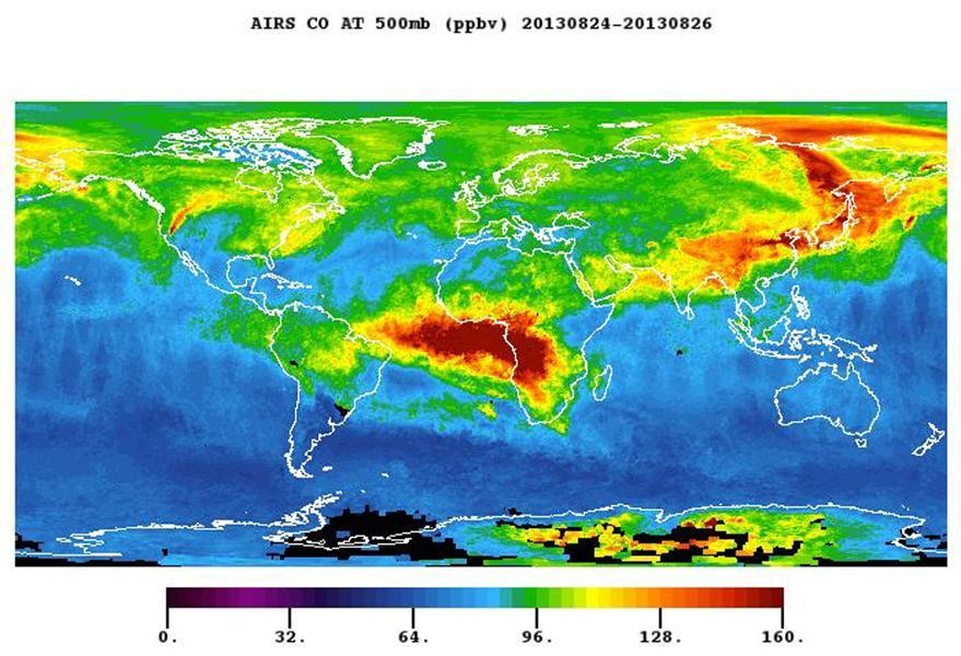
Aqua
When examining ‘Aqua’, the first thing to check in this list is the design rather than the records. This spacecraft is a satellite that observes Earth's water cycle, including water vapor, clouds, precipitation, sea ice, and sea surface temperature. Launched by NASA on May 4, 2002, it aimed at Earth as a water cycle Earth observation satellite. By looking at these four pieces of information together, we can distinguish ‘Aqua’s historical position and actual mission range that isn’t revealed by the name alone.
What’s most interesting about ‘Aqua’ is the method of connecting water-related variables during afternoon overpasses. When looking at ‘Aqua’, if the mission is completed, it’s valuable to check the last operational methods and the data left behind. The mission status of ‘Aqua’ is ‘Operational Mission’, and for decommissioned spacecraft, we should read their data and follow-up technologies left behind, while for operational spacecraft, we should focus on tasks expanded from the original plan. This way, it becomes clear that ‘Aqua’ was not just a simple record holder but a tool that solved specific problems.
Following the flow of the list, it’s worth examining ‘Aura’. Comparing ‘Aqua’s water cycle Earth observation satellite with ‘Aura’s atmospheric chemistry observation satellite reassures us that the method of reading Earth changes through repeated observations was accumulated not from a single invention but from multiple missions’ trial and error. The official page for ‘Aqua’ provides more detailed information about its launch, mission progress, and payload, so for ongoing missions where dates and statuses change, it’s safer to check the latest notices together.
What’s most interesting about ‘Aqua’ is the method of connecting water-related variables during afternoon overpasses. When looking at ‘Aqua’, if the mission is completed, it’s valuable to check the last operational methods and the data left behind. The mission status of ‘Aqua’ is ‘Operational Mission’, and for decommissioned spacecraft, we should read their data and follow-up technologies left behind, while for operational spacecraft, we should focus on tasks expanded from the original plan. This way, it becomes clear that ‘Aqua’ was not just a simple record holder but a tool that solved specific problems.
Following the flow of the list, it’s worth examining ‘Aura’. Comparing ‘Aqua’s water cycle Earth observation satellite with ‘Aura’s atmospheric chemistry observation satellite reassures us that the method of reading Earth changes through repeated observations was accumulated not from a single invention but from multiple missions’ trial and error. The official page for ‘Aqua’ provides more detailed information about its launch, mission progress, and payload, so for ongoing missions where dates and statuses change, it’s safer to check the latest notices together.
운영기관 NASA
발사일 2002-05-04
형식 물순환 지구관측위성
목표 지구
임무 상태 운용 임무
이미지 자료 NASA Image Library · NASA Aqua Spacecraft Images Pollution from California Rim Fire
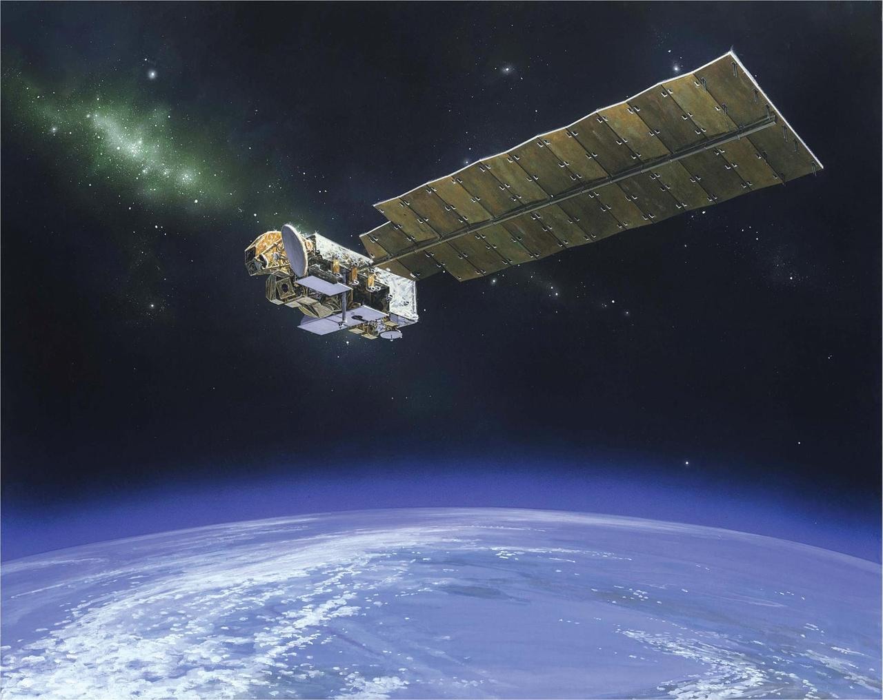
Aura
When examining ‘Aura’, the starting point for understanding this spacecraft lies in the conditions required by its mission. This spacecraft is a satellite measuring trace gases that affect the ozone layer, air quality, and climate. Launched by NASA on July 15, 2004, it aimed at Earth's atmosphere as an atmospheric chemistry observation satellite. By looking at these four pieces of information together, we can distinguish ‘Aura’s historical position and actual mission range that isn’t revealed by the name alone.
What’s most interesting about ‘Aura’ is the spectral observation that reads the vertical composition and chemical changes of the atmosphere. When looking at ‘Aura’, it’s more beneficial to see how power and mass were allocated to specific equipment rather than the size of the gases. The mission status of ‘Aura’ is ‘Operational Mission’, and for decommissioned spacecraft, we should read their data and follow-up technologies left behind, while for operational spacecraft, we should focus on tasks expanded from the original plan. This way, it becomes clear that ‘Aura’ was not just a simple record holder but a tool that solved specific problems.
Following the flow of the list, it’s worth examining ‘Suomi NPP’. Comparing ‘Aura’s atmospheric chemistry observation satellite with ‘Suomi NPP’s polar-orbiting weather and climate satellite reassures us that the method of reading Earth changes through repeated observations was accumulated not from a single invention but from multiple missions’ trial and error. The official page for ‘Aura’ provides more detailed information about its launch, mission progress, and payload, so for ongoing missions where dates and statuses change, it’s safer to check the latest notices together.
What’s most interesting about ‘Aura’ is the spectral observation that reads the vertical composition and chemical changes of the atmosphere. When looking at ‘Aura’, it’s more beneficial to see how power and mass were allocated to specific equipment rather than the size of the gases. The mission status of ‘Aura’ is ‘Operational Mission’, and for decommissioned spacecraft, we should read their data and follow-up technologies left behind, while for operational spacecraft, we should focus on tasks expanded from the original plan. This way, it becomes clear that ‘Aura’ was not just a simple record holder but a tool that solved specific problems.
Following the flow of the list, it’s worth examining ‘Suomi NPP’. Comparing ‘Aura’s atmospheric chemistry observation satellite with ‘Suomi NPP’s polar-orbiting weather and climate satellite reassures us that the method of reading Earth changes through repeated observations was accumulated not from a single invention but from multiple missions’ trial and error. The official page for ‘Aura’ provides more detailed information about its launch, mission progress, and payload, so for ongoing missions where dates and statuses change, it’s safer to check the latest notices together.
운영기관 NASA
발사일 2004-07-15
형식 대기화학 관측위성
목표 지구 대기
임무 상태 운용 임무
이미지 자료 NASA Image Library · NASA Aura Spacecraft Artist Concept

Suomi NPP
When examining ‘Suomi NPP’, an aspect that is easily overlooked when only looking at achievements lies in the choices made for the spacecraft. This spacecraft is a polar-orbiting satellite equipped with five observation instruments bridging weather forecasting and long-term climate records. Launched by NASA and NOAA on October 28, 2011, it aimed at Earth as a polar-orbiting weather and climate satellite. By looking at these four pieces of information together, we can distinguish ‘Suomi NPP’s historical position and actual mission range that isn’t revealed by the name alone.
What’s most interesting about ‘Suomi NPP’ is the use of visible-infrared imagery that captures nighttime lights. When looking at ‘Suomi NPP’, connecting the structures in the photo with the payload list will allow for more accurate understanding of the mission objectives. The mission status of ‘Suomi NPP’ is ‘Operational’, and for decommissioned spacecraft, we should read their data and follow-up technologies left behind, while for operational spacecraft, we should focus on tasks expanded from the original plan. This way, it becomes clear that ‘Suomi NPP’ was not just a simple record holder but a tool that solved specific problems.
Following the flow of the list, it’s worth examining ‘Landsat 8’. Comparing ‘Suomi NPP’s polar-orbiting weather and climate satellite with ‘Landsat 8’s optical and thermal infrared Earth observation satellite reassures us that the method of reading Earth changes through repeated observations was accumulated not from a single invention but from multiple missions’ trial and error. The official page for ‘Suomi NPP’ provides more detailed information about its launch, mission progress, and payload, so for ongoing missions where dates and statuses change, it’s safer to check the latest notices together.
What’s most interesting about ‘Suomi NPP’ is the use of visible-infrared imagery that captures nighttime lights. When looking at ‘Suomi NPP’, connecting the structures in the photo with the payload list will allow for more accurate understanding of the mission objectives. The mission status of ‘Suomi NPP’ is ‘Operational’, and for decommissioned spacecraft, we should read their data and follow-up technologies left behind, while for operational spacecraft, we should focus on tasks expanded from the original plan. This way, it becomes clear that ‘Suomi NPP’ was not just a simple record holder but a tool that solved specific problems.
Following the flow of the list, it’s worth examining ‘Landsat 8’. Comparing ‘Suomi NPP’s polar-orbiting weather and climate satellite with ‘Landsat 8’s optical and thermal infrared Earth observation satellite reassures us that the method of reading Earth changes through repeated observations was accumulated not from a single invention but from multiple missions’ trial and error. The official page for ‘Suomi NPP’ provides more detailed information about its launch, mission progress, and payload, so for ongoing missions where dates and statuses change, it’s safer to check the latest notices together.
운영기관 NASA·NOAA
발사일 2011-10-28
형식 극궤도 기상·기후위성
목표 지구
임무 상태 운용 중
이미지 자료 NASA Image Library · City Lights 2012 - Flat map
Landsat 8
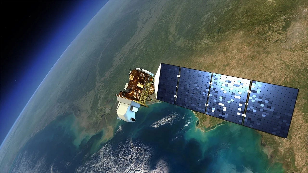
When examining ‘Landsat 8’, the changes become clear when comparing previous generations based on the launch date. This spacecraft continues the Landsat series, recording changes to land and coastlines. Launched by NASA and USGS on February 11, 2013, it aimed at Earth as an optical and thermal infrared Earth observation satellite. By looking at these four pieces of information together, we can distinguish ‘Landsat 8’s historical position and actual mission range that isn’t revealed by the name alone.
What’s most interesting about ‘Landsat 8’ is the method of comparing surface conditions by combining optical sensors and thermal sensors. When looking at ‘Landsat 8’, comparing how the information changes when the observation location varies is key. The mission status of ‘Landsat 8’ is ‘Operational’, and for decommissioned spacecraft, we should read their data and follow-up technologies left behind, while for operational spacecraft, we should focus on tasks expanded from the original plan. This way, it becomes clear that ‘Landsat 8’ was not just a simple record holder but a tool that solved specific problems.
Following the flow of the list, it’s worth examining ‘Landsat 9’. Comparing ‘Landsat 8’s optical and thermal infrared Earth observation satellite with ‘Landsat 9’s optical and thermal infrared Earth observation satellite reassures us that the method of reading Earth changes through repeated observations was accumulated not from a single invention but from multiple missions’ trial and error. The official page for ‘Landsat 8’ provides more detailed information about its launch, mission progress, and payload, so for ongoing missions where dates and statuses change, it’s safer to check the latest notices together.
What’s most interesting about ‘Landsat 8’ is the method of comparing surface conditions by combining optical sensors and thermal sensors. When looking at ‘Landsat 8’, comparing how the information changes when the observation location varies is key. The mission status of ‘Landsat 8’ is ‘Operational’, and for decommissioned spacecraft, we should read their data and follow-up technologies left behind, while for operational spacecraft, we should focus on tasks expanded from the original plan. This way, it becomes clear that ‘Landsat 8’ was not just a simple record holder but a tool that solved specific problems.
Following the flow of the list, it’s worth examining ‘Landsat 9’. Comparing ‘Landsat 8’s optical and thermal infrared Earth observation satellite with ‘Landsat 9’s optical and thermal infrared Earth observation satellite reassures us that the method of reading Earth changes through repeated observations was accumulated not from a single invention but from multiple missions’ trial and error. The official page for ‘Landsat 8’ provides more detailed information about its launch, mission progress, and payload, so for ongoing missions where dates and statuses change, it’s safer to check the latest notices together.
운영기관 NASA·USGS
발사일 2013-02-11
형식 광학·열적외선 지구관측위성
목표 지구
임무 상태 운용 중
이미지 자료 NASA Landsat · Landsat 8 spacecraft
Landsat 9
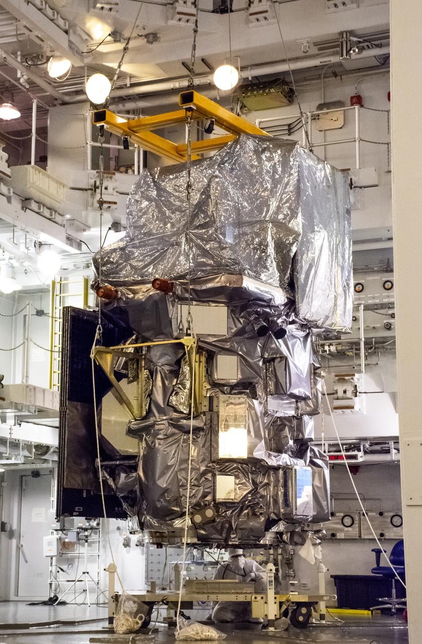
When examining ‘Landsat 9’, even though the name is familiar, the actual role is revealed only when looking at the goals and orbit together. This spacecraft is the latest generation satellite paired with Landsat 8, which observes the same locations more frequently. Launched by NASA and USGS on September 27, 2021, it aimed at Earth as an optical and thermal infrared Earth observation satellite. By looking at these four pieces of information together, we can distinguish ‘Landsat 9’s historical position and actual mission range that isn’t revealed by the name alone.
What’s most interesting about ‘Landsat 9’ is the way it reduces revisit intervals through the time-separated operation of the two satellites. When looking at ‘Landsat 9’, it’s good to find the devices that maintain the posture toward the target and the arrangement of communication equipment in the official images. The mission status of ‘Landsat 9’ is ‘Operational’, and for decommissioned spacecraft, we should read their data and follow-up technologies left behind, while for operational spacecraft, we should focus on tasks expanded from the original plan. This way, it becomes clear that ‘Landsat 9’ was not just a simple record holder but a tool that solved specific problems.
Following the flow of the list, it’s worth examining ‘PACE’. Comparing ‘Landsat 9’s optical and thermal infrared Earth observation satellite with ‘PACE’s ocean color and atmospheric observation satellite reassures us that the method of reading Earth changes through repeated observations was accumulated not from a single invention but from multiple missions’ trial and error. The official page for ‘Landsat 9’ provides more detailed information about its launch, mission progress, and payload, so for ongoing missions where dates and statuses change, it’s safer to check the latest notices together.
What’s most interesting about ‘Landsat 9’ is the way it reduces revisit intervals through the time-separated operation of the two satellites. When looking at ‘Landsat 9’, it’s good to find the devices that maintain the posture toward the target and the arrangement of communication equipment in the official images. The mission status of ‘Landsat 9’ is ‘Operational’, and for decommissioned spacecraft, we should read their data and follow-up technologies left behind, while for operational spacecraft, we should focus on tasks expanded from the original plan. This way, it becomes clear that ‘Landsat 9’ was not just a simple record holder but a tool that solved specific problems.
Following the flow of the list, it’s worth examining ‘PACE’. Comparing ‘Landsat 9’s optical and thermal infrared Earth observation satellite with ‘PACE’s ocean color and atmospheric observation satellite reassures us that the method of reading Earth changes through repeated observations was accumulated not from a single invention but from multiple missions’ trial and error. The official page for ‘Landsat 9’ provides more detailed information about its launch, mission progress, and payload, so for ongoing missions where dates and statuses change, it’s safer to check the latest notices together.
운영기관 NASA·USGS
발사일 2021-09-27
형식 광학·열적외선 지구관측위성
목표 지구
임무 상태 운용 중
이미지 자료 NASA Image Library · Landsat 9 Spacecraft Mate to EPSA
PACE
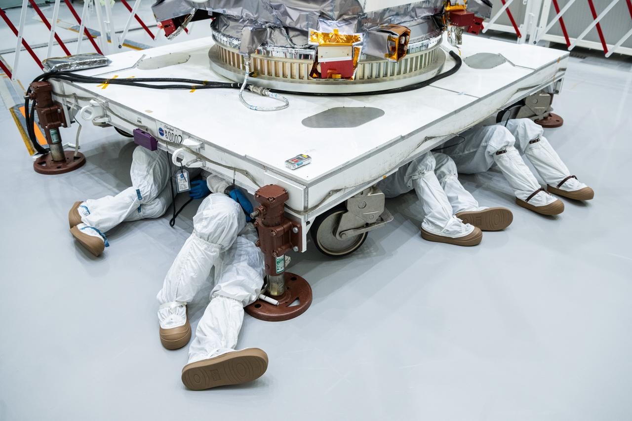
When examining ‘PACE’, the critical scene of the mission starts with hardware tailored to its objectives. This spacecraft is a satellite observing marine phytoplankton, aerosols, and clouds across a wide range of wavelengths. Launched by NASA on February 8, 2024, it aimed at Earth as an ocean color and atmospheric observation satellite. By looking at these four pieces of information together, we can distinguish ‘PACE’s historical position and actual mission range that isn’t revealed by the name alone.
What’s most interesting about ‘PACE’ is the observation that connects the marine ecosystem and atmospheric particles within the same mission. When looking at ‘PACE’ alongside contemporaneous spacecraft, the prioritization of propulsion, power, and observation equipment becomes evident. The mission status of ‘PACE’ is ‘Operational’, and for decommissioned spacecraft, we should read their data and follow-up technologies left behind, while for operational spacecraft, we should focus on tasks expanded from the original plan. This way, it becomes clear that ‘PACE’ was not just a simple record holder but a tool that solved specific problems.
Following the flow of the list, it’s worth examining ‘Landsat 1’. Comparing ‘PACE’s ocean color and atmospheric observation satellite with ‘Landsat 1’s multispectral Earth observation satellite reassures us that the method of reading Earth changes through repeated observations was accumulated not from a single invention but from multiple missions’ trial and error. The official page for ‘PACE’ provides more detailed information about its launch, mission progress, and payload, so for ongoing missions where dates and statuses change, it’s safer to check the latest notices together.
What’s most interesting about ‘PACE’ is the observation that connects the marine ecosystem and atmospheric particles within the same mission. When looking at ‘PACE’ alongside contemporaneous spacecraft, the prioritization of propulsion, power, and observation equipment becomes evident. The mission status of ‘PACE’ is ‘Operational’, and for decommissioned spacecraft, we should read their data and follow-up technologies left behind, while for operational spacecraft, we should focus on tasks expanded from the original plan. This way, it becomes clear that ‘PACE’ was not just a simple record holder but a tool that solved specific problems.
Following the flow of the list, it’s worth examining ‘Landsat 1’. Comparing ‘PACE’s ocean color and atmospheric observation satellite with ‘Landsat 1’s multispectral Earth observation satellite reassures us that the method of reading Earth changes through repeated observations was accumulated not from a single invention but from multiple missions’ trial and error. The official page for ‘PACE’ provides more detailed information about its launch, mission progress, and payload, so for ongoing missions where dates and statuses change, it’s safer to check the latest notices together.
운영기관 NASA
발사일 2024-02-08
형식 해양색·대기 관측위성
목표 지구
임무 상태 운용 중
이미지 자료 NASA Image Library · GSFC_20240117_PACE_001205
The strength of Earth observation data lies in the records that connect through the same criteria rather than a flashy single image. Like Landsat, the accumulated imagery over generations helps to confirm slow movements like urban expansion and forest changes.
When reviewing this list, let's first compare the observation targets and revisit cycles of each satellite. Different observation intervals are needed for rapid phenomena like weather and slower changes like land use. Ways to utilize public data can be found on the connected official mission pages. By checking the actual mission data and spacecraft structure of satellites that record Earth's changes every day, we can more specifically understand the reasons behind these different choices.
When reviewing this list, let's first compare the observation targets and revisit cycles of each satellite. Different observation intervals are needed for rapid phenomena like weather and slower changes like land use. Ways to utilize public data can be found on the connected official mission pages. By checking the actual mission data and spacecraft structure of satellites that record Earth's changes every day, we can more specifically understand the reasons behind these different choices.
한눈에 보기
8개
Landsat 1
NASA·USGS · 1972-07-23 · 다중분광 지구관측위성 · 지구 · 임무 종료 · NASA Image Library · Early Landsat View of Los Angeles and Vicinity
Terra
NASA · 1999-12-18 · 다중센서 지구관측위성 · 지구 · 운용 임무 · NASA Image Library · NASA Terra Spacecraft Images Thailand Flooding
Aqua
NASA · 2002-05-04 · 물순환 지구관측위성 · 지구 · 운용 임무 · NASA Image Library · NASA Aqua Spacecraft Images Pollution from California Rim Fire
Aura
NASA · 2004-07-15 · 대기화학 관측위성 · 지구 대기 · 운용 임무 · NASA Image Library · NASA Aura Spacecraft Artist Concept
Suomi NPP
NASA·NOAA · 2011-10-28 · 극궤도 기상·기후위성 · 지구 · 운용 중 · NASA Image Library · City Lights 2012 - Flat map
Landsat 8
NASA·USGS · 2013-02-11 · 광학·열적외선 지구관측위성 · 지구 · 운용 중 · NASA Landsat · Landsat 8 spacecraft
Landsat 9
NASA·USGS · 2021-09-27 · 광학·열적외선 지구관측위성 · 지구 · 운용 중 · NASA Image Library · Landsat 9 Spacecraft Mate to EPSA
PACE
NASA · 2024-02-08 · 해양색·대기 관측위성 · 지구 · 운용 중 · NASA Image Library · GSFC_20240117_PACE_001205
이 포스팅은 쿠팡 파트너스 활동의 일환으로, 이에 따른 일정액의 수수료를 제공받습니다.
댓글 0
로그인 후 댓글을 작성할 수 있습니다.
첫 댓글을 남겨보세요.
이런 리스트는 어때요?


이런 리스트도 추천해요


🎲
여기서 멈추기엔 아쉽잖아?
다음에 뭘 볼지 고민하는 시간이 제일 아까워.
주사위가 대신 골라줄게 — 무슨 리스트가 튀어나올지는 굴려봐야 알지.
안 누르면… 평생 궁금하지 않겠어? 👀
