Collection
Themed Travel
2026.10.07
Urban Walking Trails Reconnected Where the Path Was Cut Off
Eight places where elevated roads, abandoned rail lines, water plants, and streams were turned into people-first paths
Rail lines and elevated roads, water treatment plants and covered-over streams kept cities moving, but they also severed the paths people walked. When infrastructure that has lost its function is turned into walking trails and parks instead of being demolished, new neighborhoods become connected along the traces of past movement. Looking only at the finished landscaping, though, it is easy to miss the roles these places once played, such as running trains, carrying traffic, or treating water, and the debates that surrounded their regeneration.
This list selects eight linear spaces in Seoul, Gwangju, Busan, Daegu, and Gunsan that you can actually walk today. They are grouped by character so you can observe the rails and station traces of abandoned lines, the height of elevated roads, the structure of water treatment facilities, and the water level of restored streams. Because walking trails are long and have many entrances, you should save the start and end points separately rather than relying on a single representative address, and check on-site signage for shared bicycle sections, nighttime closures, and rain-related restrictions.
This list selects eight linear spaces in Seoul, Gwangju, Busan, Daegu, and Gunsan that you can actually walk today. They are grouped by character so you can observe the rails and station traces of abandoned lines, the height of elevated roads, the structure of water treatment facilities, and the water level of restored streams. Because walking trails are long and have many entrances, you should save the start and end points separately rather than relying on a single representative address, and check on-site signage for shared bicycle sections, nighttime closures, and rain-related restrictions.
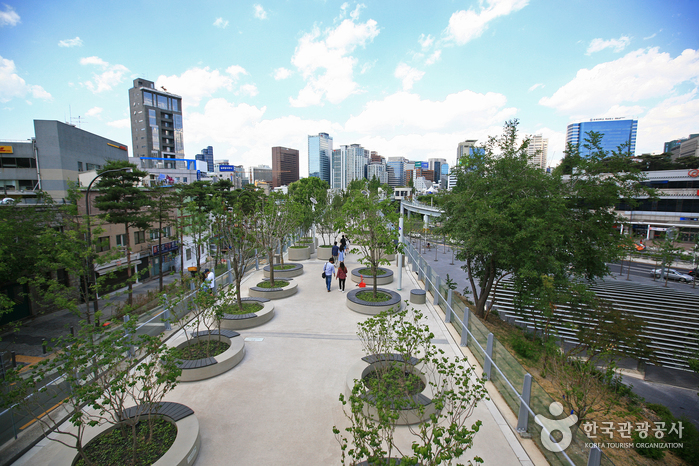
Seoullo 7017
Seoullo 7017 began its life as the Seoul Station overpass, and today it serves as a downtown pedestrian path and a planted linear park. Rather than erecting an entirely new building, the remaining structure was connected and adapted to serve as a downtown pedestrian path and planted linear park, passing the memory of the place on to its next users. The first thing to look at on site is the pedestrian structure that links the Seoul Station area at the height of a vehicle road. Instead of quickly photographing the exterior, compare step by step how the traces of the Seoul Station overpass carried over into the downtown pedestrian path and planted linear park, and the changes unique to this place reveal themselves naturally.
When preparing an actual visit, the first thing to take care of is to check the elevator locations and any closures for events or maintenance. If access conditions around 84-15 Namdaemunno 5-ga, Jung-gu, Seoul change, the publicly open extent of the downtown pedestrian path and planted linear park may be affected, so beyond the business listing on the map noting that you should check elevator locations and event or maintenance closures, it is safer to confirm again with the latest notices. At Seoullo 7017, distinguish the public viewing areas from the living spaces of residents and tenants, and when recording the pedestrian structure that links the Seoul Station area at the height of a vehicle road, avoid obstructing passage or work so that your trip respects the place's present use.
When preparing an actual visit, the first thing to take care of is to check the elevator locations and any closures for events or maintenance. If access conditions around 84-15 Namdaemunno 5-ga, Jung-gu, Seoul change, the publicly open extent of the downtown pedestrian path and planted linear park may be affected, so beyond the business listing on the map noting that you should check elevator locations and event or maintenance closures, it is safer to confirm again with the latest notices. At Seoullo 7017, distinguish the public viewing areas from the living spaces of residents and tenants, and when recording the pedestrian structure that links the Seoul Station area at the height of a vehicle road, avoid obstructing passage or work so that your trip respects the place's present use.
도로명주소 서울 중구 남대문로5가 84-15
위치 서울 중구 서울역 고가 보행로
지번주소 서울 중구 남대문로5가 84-15
저녁 운영 조건 보행로 24시간 개방 안내 · 부속 시설은 별도 운영
과거 용도 서울역 고가차도
두 시간 배분 제안 18:30–19:20 원하는 짧은 구간 왕복 + 19:20–20:30 주변 이동·식사(편집 제안)
현재 쓰임 도심 보행길과 식재형 선형공원
비용 범위 보행로 입장 무료 · 식사·교통·주차 별도
현장 관찰점 차량 도로의 높이에서 서울역 일대를 연결한 보행 구조
퇴근 전 확인 전 구간 완주 대신 귀가 방향 가까운 진입부 선택. 날씨·공사·엘리베이터 상태 확인.
방문 전 확인 엘리베이터 위치와 행사·보수 통제를 확인한다
공개 전화번호 검색 결과 미표시
공식 관광정보 https://korean.visitkorea.or.kr/search/search_list.do?keyword=%EC%84%9C%EC%9A%B8%EB%A1%9C7017
Seonyudo Park
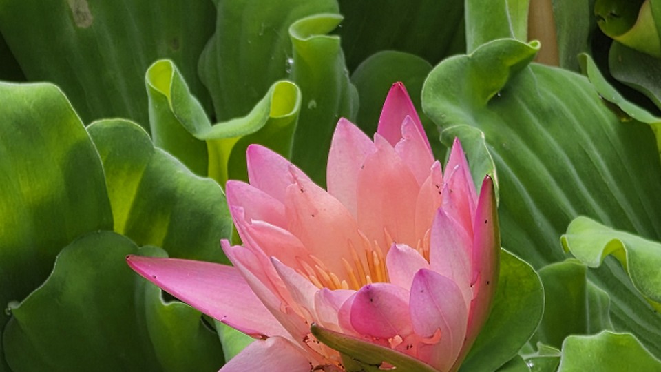
Seonyudo Park began its life as a Han River water treatment plant, and today it serves as a water purification garden, exhibition space, and walking area. Rather than erecting an entirely new building, the remaining structure was connected and adapted to serve as a water purification garden, exhibition space, and walking area, passing the memory of the place on to its next users. The first thing to look at on site is the way the water treatment structures, such as the sedimentation basins and channels, were left in place as gardens. Instead of quickly photographing the exterior, compare step by step how the traces of the Han River water treatment plant carried over into the water purification garden, exhibition space, and walking area, and the changes unique to this place reveal themselves naturally.
When preparing an actual visit, the first thing to take care of is to check the operation of the pedestrian bridge and the nighttime closing time. If access conditions around 343 Seonyu-ro, Yeongdeungpo-gu, Seoul change, the publicly open extent of the water purification garden, exhibition space, and walking area may be affected, so beyond the business listing on the map noting that you should check the pedestrian bridge operation and nighttime closing time, it is safer to confirm again with the latest notices. At Seonyudo Park, distinguish the public viewing areas from the living spaces of residents and tenants, and when recording the way the water treatment structures such as the sedimentation basins and channels were left as gardens, avoid obstructing passage or work so that your trip respects the place's present use.
When preparing an actual visit, the first thing to take care of is to check the operation of the pedestrian bridge and the nighttime closing time. If access conditions around 343 Seonyu-ro, Yeongdeungpo-gu, Seoul change, the publicly open extent of the water purification garden, exhibition space, and walking area may be affected, so beyond the business listing on the map noting that you should check the pedestrian bridge operation and nighttime closing time, it is safer to confirm again with the latest notices. At Seonyudo Park, distinguish the public viewing areas from the living spaces of residents and tenants, and when recording the way the water treatment structures such as the sedimentation basins and channels were left as gardens, avoid obstructing passage or work so that your trip respects the place's present use.
도로명주소 서울 영등포구 선유로 343
지번주소 서울 영등포구 당산동 1
과거 용도 한강 정수장
현재 쓰임 수질정화원·전시·산책 공간
현장 관찰점 침전지와 수로 등 물 처리 구조를 정원으로 남긴 방식
방문 전 확인 보행교 운영과 야간 퇴장 시간을 확인한다
공개 전화번호 02-2631-9368
공식 관광정보 https://korean.visitkorea.or.kr/search/search_list.do?keyword=%EC%84%A0%EC%9C%A0%EB%8F%84%EA%B3%B5%EC%9B%90
이미지 출처 https://img1.kakaocdn.net/cthumb/local/C800x400.q50/?fname=http%3A%2F%2Ft1.kakaocdn.net%2Flocal%2FkakaomapPhoto%2Freview%2F21ee1651c36adcdf044a87abc809e341b7e56171%3Foriginal
Gyeongui Line Forest Path
Gyeongui Line Forest Park
Gyeongui Line Forest Park began its life as the at-grade section of the Gyeongui Line railway, and today it serves as a linear park linking residential areas and commercial districts. Rather than erecting an entirely new building, the remaining structure was connected and adapted to serve as a linear park linking residential areas and commercial districts, passing the memory of the place on to its next users. The first thing to look at on site is how each section differs in the way the rail traces connect with the neighborhoods around the former stations. Instead of quickly photographing the exterior, compare step by step how the traces of the at-grade Gyeongui Line railway section carried over into the linear park linking residential areas and commercial districts, and the changes unique to this place reveal themselves naturally.
When preparing an actual visit, the first thing to take care of is to check the bicycle and pedestrian congestion and the entrances for each section. If access conditions around 190-1 Donggyo-dong, Mapo-gu, Seoul change, the publicly open extent of the linear park linking residential areas and commercial districts may be affected, so beyond the business listing on the map noting that you should check bicycle and pedestrian congestion and the entrances for each section, it is safer to confirm again with the latest notices. At Gyeongui Line Forest Park, distinguish the public viewing areas from the living spaces of residents and tenants, and when recording the section-by-section differences in how the rail traces connect with the neighborhoods around the stations, avoid obstructing passage or work so that your trip respects the place's present use.
When preparing an actual visit, the first thing to take care of is to check the bicycle and pedestrian congestion and the entrances for each section. If access conditions around 190-1 Donggyo-dong, Mapo-gu, Seoul change, the publicly open extent of the linear park linking residential areas and commercial districts may be affected, so beyond the business listing on the map noting that you should check bicycle and pedestrian congestion and the entrances for each section, it is safer to confirm again with the latest notices. At Gyeongui Line Forest Park, distinguish the public viewing areas from the living spaces of residents and tenants, and when recording the section-by-section differences in how the rail traces connect with the neighborhoods around the stations, avoid obstructing passage or work so that your trip respects the place's present use.
도로명주소 서울 마포구 양화로 188
공개 전화번호 02-719-8830
이용시간 상시 개방 · 행사·정비에 따른 일부 구간 통제는 현장 안내 확인
과거 용도 지상 경의선 철도 구간
현재 쓰임 주거지와 상권을 잇는 선형공원
현장 관찰점 레일 흔적과 역 주변 동네가 연결되는 구간별 차이
방문 전 확인 자전거·보행 혼잡과 구간별 출입구를 확인한다
공식 관광정보 https://korean.visitkorea.or.kr/search/search_list.do?keyword=%EA%B2%BD%EC%9D%98%EC%84%A0%EC%88%B2%EA%B8%B8
Gyeongchun Line Forest Path
Gyeongchun Line Forest Park
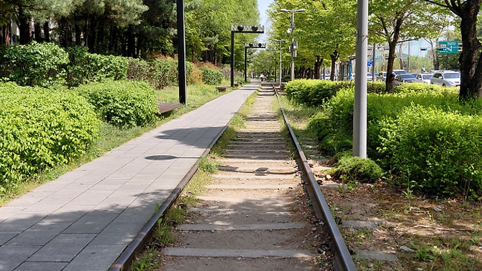
Gyeongchun Line Forest Park began its life as a section of the old Gyeongchun Line railway, and today it serves as a walking trail where railway heritage and greenery run together. Rather than erecting an entirely new building, the remaining structure was connected and adapted to serve as a walking trail where railway heritage and greenery run together, passing the memory of the place on to its next users. The first thing to look at on site is the connection between the abandoned rails, Hwarangdae Station, and the residential area. Instead of quickly photographing the exterior, compare step by step how the traces of the old Gyeongchun Line railway section carried over into the walking trail where railway heritage and greenery run together, and the changes unique to this place reveal themselves naturally.
When preparing an actual visit, the first thing to take care of is to check the length of each section and the operating status of the tram exhibition. If access conditions around 320-2 Gongneung-dong, Nowon-gu, Seoul change, the publicly open extent of the walking trail where railway heritage and greenery run together may be affected, so beyond the business listing on the map noting that you should check section lengths and the tram exhibition operation, it is safer to confirm again with the latest notices. At Gyeongchun Line Forest Park, distinguish the public viewing areas from the living spaces of residents and tenants, and when recording the connection between the abandoned rails, Hwarangdae Station, and the residential area, avoid obstructing passage or work so that your trip respects the place's present use.
When preparing an actual visit, the first thing to take care of is to check the length of each section and the operating status of the tram exhibition. If access conditions around 320-2 Gongneung-dong, Nowon-gu, Seoul change, the publicly open extent of the walking trail where railway heritage and greenery run together may be affected, so beyond the business listing on the map noting that you should check section lengths and the tram exhibition operation, it is safer to confirm again with the latest notices. At Gyeongchun Line Forest Park, distinguish the public viewing areas from the living spaces of residents and tenants, and when recording the connection between the abandoned rails, Hwarangdae Station, and the residential area, avoid obstructing passage or work so that your trip respects the place's present use.
도로명주소 서울 노원구 공릉동 320-2
지번주소 서울 노원구 공릉동 320-2
과거 용도 옛 경춘선 철도 구간
현재 쓰임 철도문화와 녹지가 이어지는 산책로
현장 관찰점 폐선 레일과 화랑대역·주거지 사이의 연결
방문 전 확인 구간 길이와 노면전차 전시 운영을 확인한다
공개 전화번호 검색 결과 미표시
공식 관광정보 https://korean.visitkorea.or.kr/search/search_list.do?keyword=%EA%B2%BD%EC%B6%98%EC%84%A0%EC%88%B2%EA%B8%B8
이미지 출처 https://img1.kakaocdn.net/cthumb/local/C800x400.q50/?fname=http%3A%2F%2Ft1.kakaocdn.net%2Flocal%2FkakaomapPhoto%2Freview%2Fc8e56e552cdc1000b558b273318574b655dc26de%3Foriginal
Pureungil Park
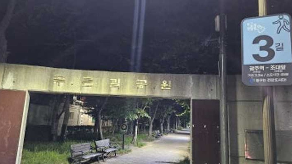
Pureungil Park began its life as the abandoned Gyeongjeon Line that once ran through the city center, and today it serves as a long-distance linear park linking neighborhoods. Rather than erecting an entirely new building, the remaining structure was connected and adapted to serve as a long-distance linear park linking neighborhoods, passing the memory of the place on to its next users. The first thing to look at on site is how the old railway axis meets residential areas, markets, and cultural spaces. Instead of quickly photographing the exterior, compare step by step how the traces of the abandoned Gyeongjeon Line that ran through the city center carried over into the long-distance linear park linking neighborhoods, and the changes unique to this place reveal themselves naturally.
When preparing an actual visit, the first thing to take care of is to check the shared bicycle sections and any construction zones. If access conditions around 730 Gyerim-dong, Dong-gu, Jeonnam-Gwangju Integrated Special City change, the publicly open extent of the long-distance linear park linking neighborhoods may be affected, so beyond the business listing on the map noting that you should check shared bicycle sections and construction zones, it is safer to confirm again with the latest notices. At Pureungil Park, distinguish the public viewing areas from the living spaces of residents and tenants, and when recording how the old railway axis meets residential areas, markets, and cultural spaces, avoid obstructing passage or work so that your trip respects the place's present use.
When preparing an actual visit, the first thing to take care of is to check the shared bicycle sections and any construction zones. If access conditions around 730 Gyerim-dong, Dong-gu, Jeonnam-Gwangju Integrated Special City change, the publicly open extent of the long-distance linear park linking neighborhoods may be affected, so beyond the business listing on the map noting that you should check shared bicycle sections and construction zones, it is safer to confirm again with the latest notices. At Pureungil Park, distinguish the public viewing areas from the living spaces of residents and tenants, and when recording how the old railway axis meets residential areas, markets, and cultural spaces, avoid obstructing passage or work so that your trip respects the place's present use.
도로명주소 전남광주통합특별시 동구 계림동 730
지번주소 전남광주통합특별시 동구 계림동 730
과거 용도 도심을 지나던 경전선 폐선
현재 쓰임 동네를 잇는 장거리 선형공원
현장 관찰점 옛 철길 축이 주거지·시장·문화공간과 만나는 모습
방문 전 확인 자전거 겸용 구간과 공사 구간을 확인한다
공개 전화번호 검색 결과 미표시
공식 관광정보 https://korean.visitkorea.or.kr/search/search_list.do?keyword=%ED%91%B8%EB%A5%B8%EA%B8%B8%EA%B3%B5%EC%9B%90
이미지 출처 https://img1.kakaocdn.net/cthumb/local/C800x400.q50/?fname=https%3A%2F%2Fpostfiles.pstatic.net%2FMjAyNjA4MDFfMTA1%2FMDAxNzg1NTUyMTA1MzUz.K-CirgC1NGphilImtok_Xx5qx0lsbQXkPFmVAosmTJsg.-xo8VrJdEjpKq8mMh9yGCKoaLyWVJGD9pZ5zrPS2rzUg.JPEG%2FKakaoTalk_20260801_105356162_03.jpg%3Ftype%3Dw386
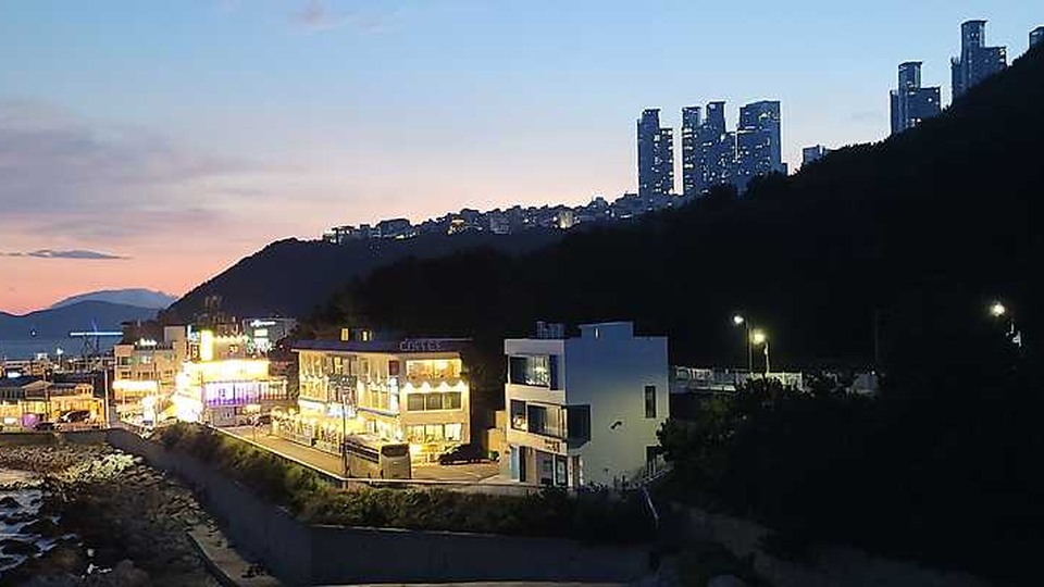
Green Railway
Green Railway began its life as a section of the old Donghae Nambu Line railway, and today it serves as a linear park combining a coastal walk with a bicycle path. Rather than erecting an entirely new building, the remaining structure was connected and adapted to serve as a linear park combining a coastal walk with a bicycle path, passing the memory of the place on to its next users. The first thing to look at on site is the railway and sea scenery stretching from Mipo through Cheongsapo to Songjeong. Instead of quickly photographing the exterior, compare step by step how the traces of the old Donghae Nambu Line railway section carried over into the linear park combining a coastal walk with a bicycle path, and the changes unique to this place reveal themselves naturally.
When preparing an actual visit, the first thing to take care of is to keep the beach train tracks separate from the walkway and check the sunset time. If access conditions around San 42-7 Jung-dong, Haeundae-gu, Busan change, the publicly open extent of the linear park combining a coastal walk with a bicycle path may be affected, so beyond the business listing on the map noting that you should keep the beach train tracks separate from the walkway and check the sunset, it is safer to confirm again with the latest notices. At Green Railway, distinguish the public viewing areas from the living spaces of residents and tenants, and when recording the railway and sea scenery stretching from Mipo through Cheongsapo to Songjeong, avoid obstructing passage or work so that your trip respects the place's present use.
When preparing an actual visit, the first thing to take care of is to keep the beach train tracks separate from the walkway and check the sunset time. If access conditions around San 42-7 Jung-dong, Haeundae-gu, Busan change, the publicly open extent of the linear park combining a coastal walk with a bicycle path may be affected, so beyond the business listing on the map noting that you should keep the beach train tracks separate from the walkway and check the sunset, it is safer to confirm again with the latest notices. At Green Railway, distinguish the public viewing areas from the living spaces of residents and tenants, and when recording the railway and sea scenery stretching from Mipo through Cheongsapo to Songjeong, avoid obstructing passage or work so that your trip respects the place's present use.
도로명주소 부산 해운대구 중동 산 42-7
지번주소 부산 해운대구 중동 산 42-7
과거 용도 동해남부선 옛 철도 구간
현재 쓰임 해안 산책과 자전거길이 결합된 선형공원
현장 관찰점 미포·청사포·송정으로 이어지는 철길과 바다 경관
방문 전 확인 해변열차 선로와 보행로를 구분하고 일몰을 확인한다
공개 전화번호 검색 결과 미표시
공식 관광정보 https://korean.visitkorea.or.kr/search/search_list.do?keyword=%ED%95%B4%EC%9A%B4%EB%8C%80%20%EA%B7%B8%EB%A6%B0%EB%A0%88%EC%9D%BC%EC%9B%A8%EC%9D%B4
이미지 출처 https://img1.kakaocdn.net/cthumb/local/C800x400.q50/?fname=https%3A%2F%2Fblog.kakaocdn.net%2Fdn%2F4H5I2%2FdJMb9NVYGIh%2Fi2PvfOqxRXnLayvQInKcT0%2Ftfile.jpg
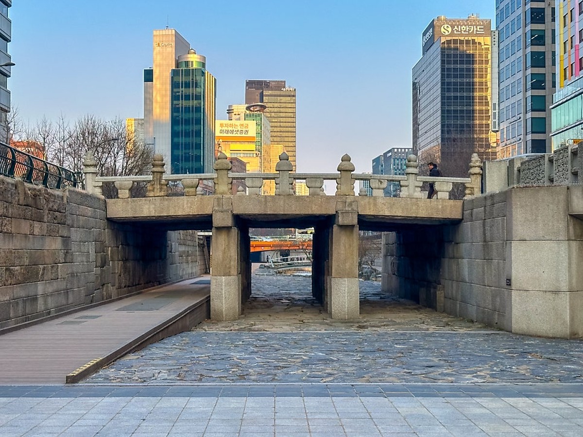
Cheonggyecheon Stream
Cheonggyecheon
Cheonggyecheon began its life as a stream buried beneath a covered road and the Cheonggye elevated expressway, and today it serves as a downtown waterside pedestrian axis and ecological space. Rather than erecting an entirely new building, the remaining structure was connected and adapted to serve as a downtown waterside pedestrian axis and ecological space, passing the memory of the place on to its next users. The first thing to look at on site is the process by which a road-centered structure was transformed into a pedestrian space centered on the waterway. Instead of quickly photographing the exterior, compare step by step how the traces of the stream buried beneath the covered road and the Cheonggye elevated expressway carried over into the downtown waterside pedestrian axis and ecological space, and the changes unique to this place reveal themselves naturally.
When preparing an actual visit, the first thing to take care of is to check for access restrictions during heavy rain and the locations of the entry and exit stairs. If access conditions around 148 Seorin-dong, Jongno-gu, Seoul change, the publicly open extent of the downtown waterside pedestrian axis and ecological space may be affected, so beyond the business listing on the map noting that you should check heavy-rain access restrictions and the locations of entry and exit stairs, it is safer to confirm again with the latest notices. At Cheonggyecheon, distinguish the public viewing areas from the living spaces of residents and tenants, and when recording the process by which a road-centered structure became a pedestrian space centered on the waterway, avoid obstructing passage or work so that your trip respects the place's present use.
When preparing an actual visit, the first thing to take care of is to check for access restrictions during heavy rain and the locations of the entry and exit stairs. If access conditions around 148 Seorin-dong, Jongno-gu, Seoul change, the publicly open extent of the downtown waterside pedestrian axis and ecological space may be affected, so beyond the business listing on the map noting that you should check heavy-rain access restrictions and the locations of entry and exit stairs, it is safer to confirm again with the latest notices. At Cheonggyecheon, distinguish the public viewing areas from the living spaces of residents and tenants, and when recording the process by which a road-centered structure became a pedestrian space centered on the waterway, avoid obstructing passage or work so that your trip respects the place's present use.
주소 서울 중구 청계광장·모전교 일대
영업시간 하천 산책로는 기상·수위·정비에 따른 당일 통제 공지 확인
전화 별도 대표번호 미확인 · 시설 공식 안내에서 관리기관 문의처 확인
저녁 운영 조건 하천 산책로는 당일 통제·정비 공지를 먼저 확인
과거 용도 복개도로와 청계고가 아래 묻혔던 하천
두 시간 배분 제안 18:30–19:10 청계광장·모전교 가까운 구간 + 19:10–20:30 주변 식사·귀가 이동(편집 제안)
현재 쓰임 도심 수변 보행축과 생태 공간
비용 범위 산책로 이용 무료 · 식사·교통·주차 별도
현장 관찰점 도로 중심 구조에서 물길 중심 보행 공간으로 바뀐 과정
퇴근 전 확인 전 구간 답사 제외. 비·수위·산책로 통제 시 내려가지 않고 다른 목적지 선택.
방문 전 확인 집중호우 출입 통제와 진출입 계단 위치를 확인한다
공식 관광정보 https://korean.visitkorea.or.kr/search/search_list.do?keyword=%EC%B2%AD%EA%B3%84%EC%B2%9C
공식 안내 https://www.sisul.or.kr/open_content/cheonggye/
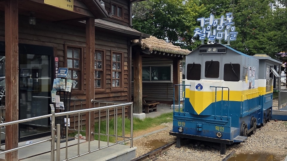
Gyeongam-dong Railway Village
Gyeongam-dong Railroad Village
Gyeongam-dong Railroad Village began its life as a village alongside the Gunsan Line railway that carried factory goods, and today it serves as a railway walk and an alley for sightseeing into everyday local history. Rather than erecting an entirely new building, the remaining structure was connected and adapted to serve as a railway walk and an alley for sightseeing into everyday local history, passing the memory of the place on to its next users. The first thing to look at on site is the scenery of the narrow railway along which freight trains once passed between the houses. Instead of quickly photographing the exterior, compare step by step how the traces of the village alongside the Gunsan Line railway that carried factory goods carried over into the railway walk and alley for sightseeing into everyday local history, and the changes unique to this place reveal themselves naturally.
When preparing an actual visit, the first thing to take care of is to be considerate of residents' spaces outside the commercial section and of vehicle traffic. If access conditions around 14 Gyeongchon 4-gil, Gunsan-si, Jeonbuk State change, the publicly open extent of the railway walk and alley for sightseeing into everyday local history may be affected, so beyond the business listing on the map noting that you should be considerate of residents' spaces outside the commercial section and of vehicle traffic, it is safer to confirm again with the latest notices. At Gyeongam-dong Railroad Village, distinguish the public viewing areas from the living spaces of residents and tenants, and when recording the scenery of the narrow railway along which freight trains once passed between the houses, avoid obstructing passage or work so that your trip respects the place's present use.
When preparing an actual visit, the first thing to take care of is to be considerate of residents' spaces outside the commercial section and of vehicle traffic. If access conditions around 14 Gyeongchon 4-gil, Gunsan-si, Jeonbuk State change, the publicly open extent of the railway walk and alley for sightseeing into everyday local history may be affected, so beyond the business listing on the map noting that you should be considerate of residents' spaces outside the commercial section and of vehicle traffic, it is safer to confirm again with the latest notices. At Gyeongam-dong Railroad Village, distinguish the public viewing areas from the living spaces of residents and tenants, and when recording the scenery of the narrow railway along which freight trains once passed between the houses, avoid obstructing passage or work so that your trip respects the place's present use.
도로명주소 전북특별자치도 군산시 경촌4길 14
지번주소 전북특별자치도 군산시 경암동 539-4
과거 용도 공장 물자를 운반하던 군산선 철길 주변 마을
현재 쓰임 철길 산책과 생활사 관광 골목
현장 관찰점 주택 사이로 지나던 화물열차의 좁은 철길 풍경
방문 전 확인 상업 구간 밖 주민 공간과 차량 통행을 배려한다
공개 전화번호 검색 결과 미표시
공식 관광정보 https://korean.visitkorea.or.kr/search/search_list.do?keyword=%EA%B2%BD%EC%95%94%EB%8F%99%EC%B2%A0%EA%B8%B8%EB%A7%88%EC%9D%84
이미지 출처 https://img1.kakaocdn.net/cthumb/local/C800x400.q50/?fname=http%3A%2F%2Ft1.kakaocdn.net%2Flocal%2FkakaomapPhoto%2Freview%2Fe6b635afa4a1049bfc60f9bafbffb30526eecb68%3Foriginal
With linear regeneration spaces, what matters is not a single landmark but how the urban fabric was reconnected. Seoullo 7017 turns the height of a vehicle overpass into a walking experience, while Gyeongui Line Forest Park, Gyeongchun Line Forest Park, and Gwangju's Pureungil Park carry the long ribbon left by the railways onward as neighborhood parks. At Seonyudo Park, structures that once treated water have become gardens, and at Cheonggyecheon you can see how a waterway hidden beneath a covered road and an elevated expressway has returned as a pedestrian axis through the city center.
Before you set out, choose a 2 to 4 km section that fits your purpose rather than attempting the full length. In abandoned-rail parks, railway crossings and bicycles intersect, and waterside paths may be closed after heavy rain. Rather than rushing through only the commercialized sections, recording the remaining rails, piers, basins, and retaining walls together with the neighborhood entrances makes it easier to understand how infrastructure was transformed into public space. Late in the day, also check the lighting and the last public transit departures.
Before you set out, choose a 2 to 4 km section that fits your purpose rather than attempting the full length. In abandoned-rail parks, railway crossings and bicycles intersect, and waterside paths may be closed after heavy rain. Rather than rushing through only the commercialized sections, recording the remaining rails, piers, basins, and retaining walls together with the neighborhood entrances makes it easier to understand how infrastructure was transformed into public space. Late in the day, also check the lighting and the last public transit departures.
At a glance
8 items
Seoullo 7017
서울 중구 서울역 고가 보행로서울역 고가차도도심 보행길과 식재형 선형공원
Seonyudo Park
서울 영등포구 선유로 343서울 영등포구 당산동 1한강 정수장
Gyeongui Line Forest Path
서울 마포구 양화로 18802-719-8830지상 경의선 철도 구간
Gyeongchun Line Forest Path
서울 노원구 공릉동 320-2서울 노원구 공릉동 320-2옛 경춘선 철도 구간
Pureungil Park
도심을 지나던 경전선 폐선동네를 잇는 장거리 선형공원검색 결과 미표시
Green Railway
동해남부선 옛 철도 구간검색 결과 미표시
Cheonggyecheon Stream
도심 수변 보행축과 생태 공간
Gyeongam-dong Railway Village
철길 산책과 생활사 관광 골목검색 결과 미표시
Locations at a glance
8 places
As part of the Coupang Partners program, this post may earn a commission from qualifying purchases.
Comments 0
Log in to leave a comment.
Be the first to comment.
How about these lists?


You might also like


🎲
Not ready to stop here?
Wondering what to read next is the biggest waste of time.
Let the dice decide — you won't know what pops up until you roll.
If you don't press it… won't you wonder forever? 👀