Collection
Domestic Travel
2026.08.21
Passing the Lake and Climbing the Ridge Opens Up Damyang
Nature viewpoint photos leading from Damyang Lake to the fortress and valleys
The natural photos of Damyang unfold in a different direction from the flat bamboo forests. At Damyang Lake and Yongmaru-gil, the calm surface meets the ridges of Chuwolsan, and climbing up the mountain opens views of the lake and plains below. The stone paths of Geumseongsanseong, the valley of Gamagol, and Yongheungsa, as well as the ridges of Byeongpungsan and Saminsan show various ratios of water, rocks, forests, and urban landscapes.
This list includes 8 actual places with different difficulty levels, ranging from accessible water's edge walks to more strenuous mountain hikes. Instead of merely repeating landscape descriptions, we provide insights into features visible in the photos, like reflections, deck curves, cliffs, fortress walls, long-exposure valley shots, and plains views, along with weather, access controls, and descent safety information.
This list includes 8 actual places with different difficulty levels, ranging from accessible water's edge walks to more strenuous mountain hikes. Instead of merely repeating landscape descriptions, we provide insights into features visible in the photos, like reflections, deck curves, cliffs, fortress walls, long-exposure valley shots, and plains views, along with weather, access controls, and descent safety information.
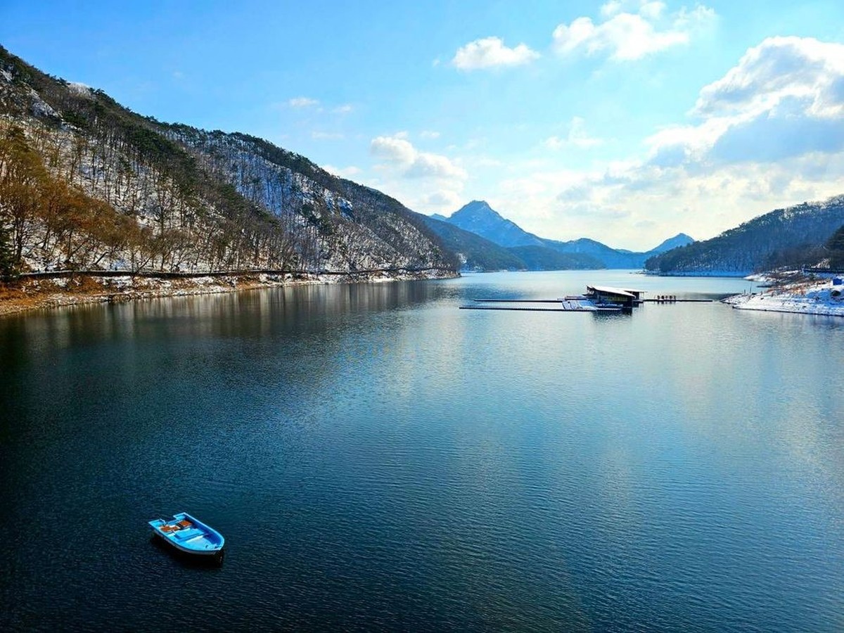
Damyangho
Damyang Lake
Damyangho suits anyone who wants calm water and a mountain ridge in one shot without hiking. The basic composition simply splits the wide surface of the lake and the Chuwolsan ridge horizontally, so the result is stiller than at Yongmaru-gil, where the curve of the deck leads the eye. On heavy fog days, shooting from the edge of the road is dangerous, and the safe place to shoot is inside the waterside safety line.
주소 전라남도 담양군 용면 월계리 411-6
촬영 포인트 넓은 수면과 추월산 능선을 수평으로 나누면 담양 북쪽의 깊고 차분한 산수 풍경이 완성된다.
추천 시간 바람이 적은 일출 후
현장 팁 수변 안전선과 주차 규정을 지키고 안개가 짙을 때 도로 가장자리 촬영을 피한다.
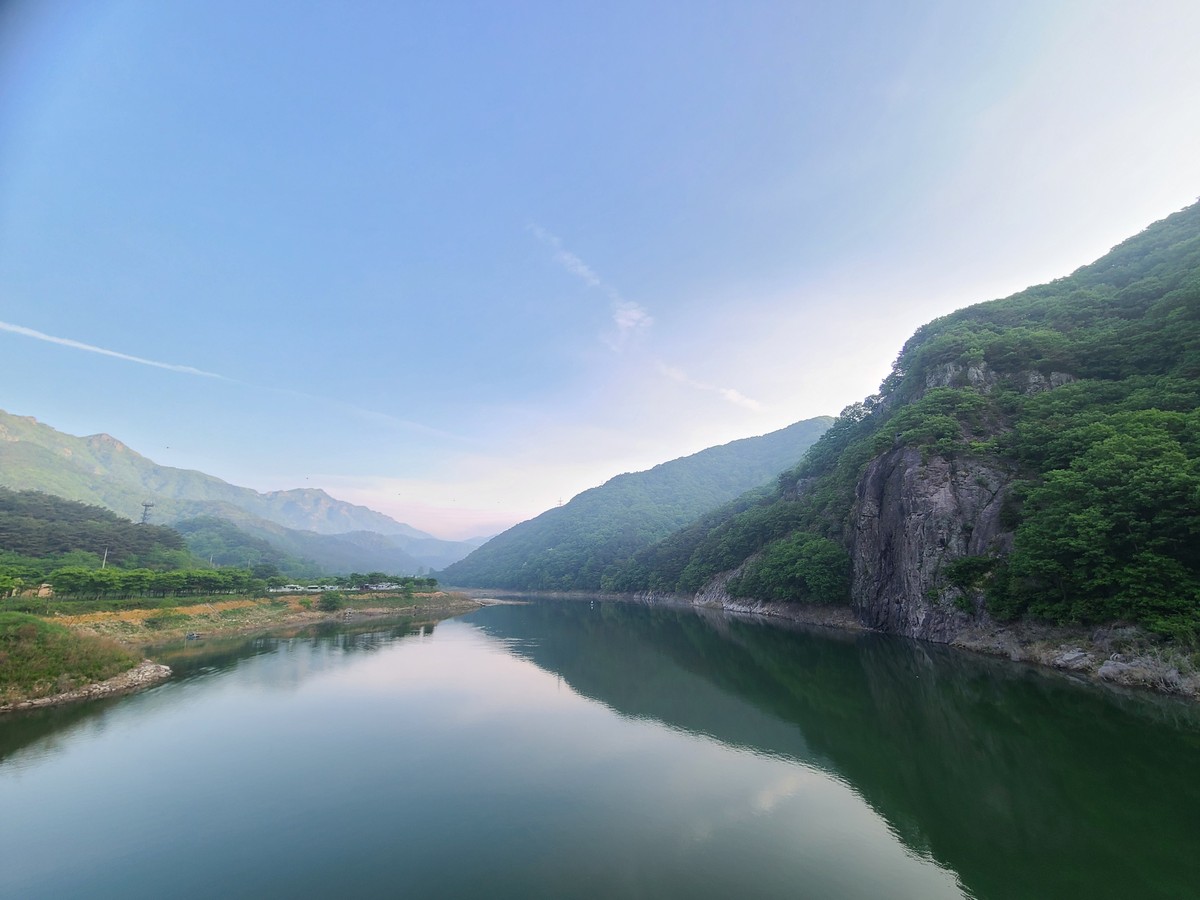
Damyangho Yongmaru-gil
Damyang Lake Yongmaru-gil
Damyangho Yongmaru-gil suits anyone who wants to walk along the lake and put the flow of the path itself into the picture. While shots of Damyangho from the shore rely on a horizontal split of water and ridge, here the curve of the wooden deck draws the eye far toward the lake and Chuwolsan. The deck may be closed or under maintenance, and it is considerate not to set up a tripod where it blocks walkers.
주소 전라남도 담양군 용면 월계리 산 90-9
촬영 포인트 목재 데크의 곡선과 호수, 추월산을 겹치면 걷는 방향을 따라 시선이 길게 이어진다.
추천 시간 햇빛이 낮은 오전
현장 팁 데크 통행을 막는 삼각대 사용을 피하고 폐쇄·정비 정보를 확인한다.
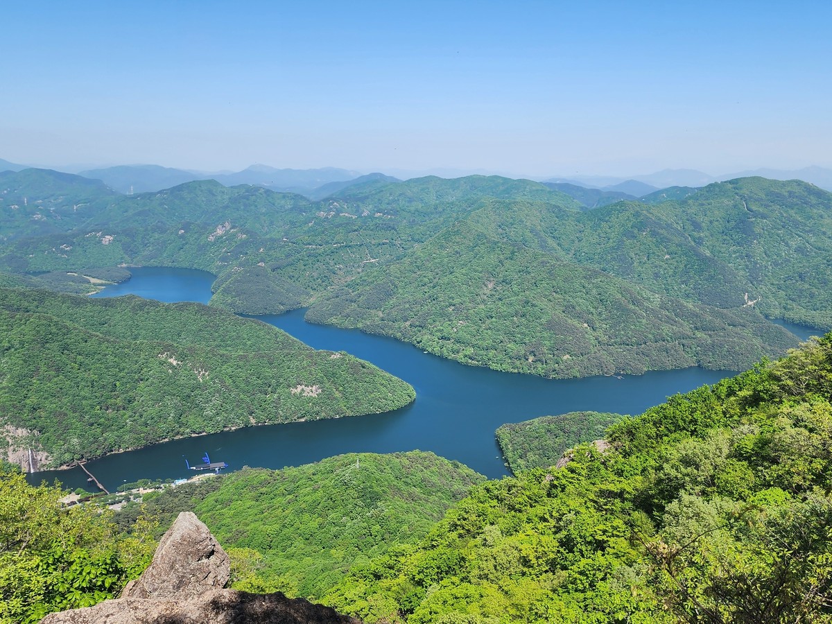
Chuwolsan
Chuwolsan suits anyone who wants to climb up and look down on Damyangho from above. Standing on the ridge you saw from the shore, you get the rocky crest and the lake in one frame, a strong contrast between the height of the mountain and the breadth of the water. There are steep and rocky sections, so wear suitable shoes and check the weather and trail conditions before you set out.
주소 전라남도 담양군 용면 월계리 산 81 일대
촬영 포인트 암릉과 담양호를 함께 내려다보면 산의 높이와 호수의 넓이가 강한 대비를 만든다.
추천 시간 시정이 좋은 오전
현장 팁 급경사와 암릉 구간에 맞는 신발을 신고 기상과 탐방로 상태를 확인한다.
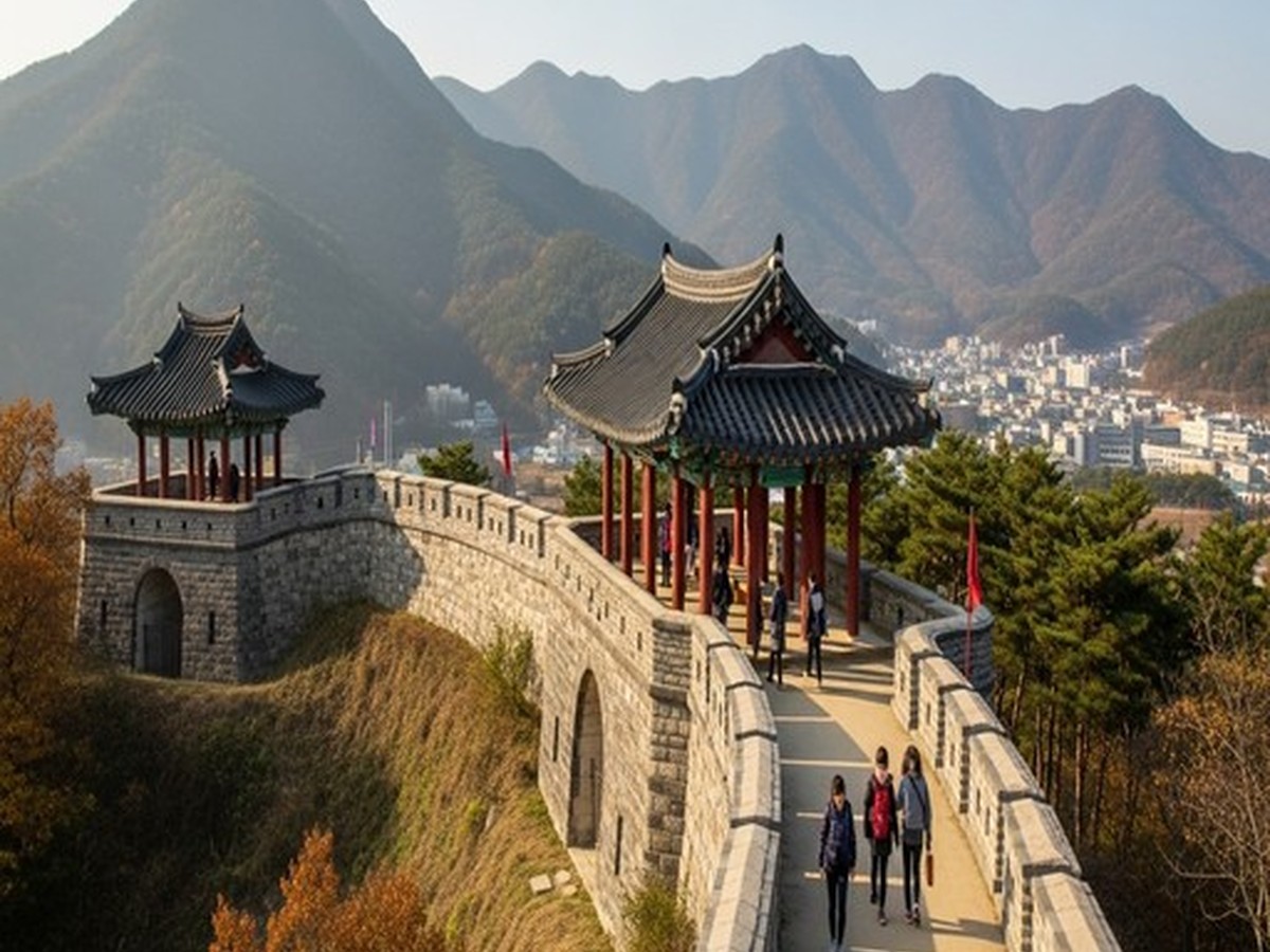
Geumseong Sanseong
Geumseongsanseong
Geumseong Sanseong suits anyone who wants to add the lines of a historic site to a mountain landscape. Where the other mountains offer rocky crests or views over the plains, here the curve of the fortress wall in the foreground layered with the ridgeline reveals how the defenses relate to the terrain. The narrow stretches atop the wall and the slippery stone paths call for giving way to one another, and climbing on the stones can damage them.
주소 전라남도 담양군 금성면 금성리 산 91-3
촬영 포인트 성벽의 곡선을 전경에 두고 산 능선을 겹치면 방어 유적과 자연 지형의 관계가 드러난다.
추천 시간 성벽에 측면광이 드는 오후
현장 팁 성벽 위 좁은 구간에서 양보하고 돌에 올라가거나 유적을 훼손하지 않는다.
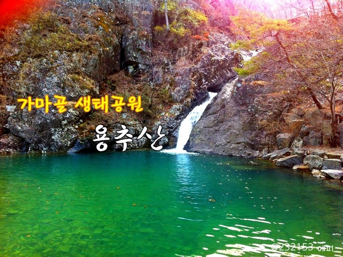
Gamagol Eco Park
Gamagol Ecological Park
Gamagol Eco Park suits anyone looking for deep valleys and forest greenery rather than open views. Unlike Yongheungsa Valley, which centers on broad rocks and water, it combines a deep valley at Damyang's northern tip, forest trails and the colored water of Yongso. After heavy rain the valley may be closed or at risk of falling rocks, so staying behind the waterside safety line matters above all.
주소 전라남도 담양군 용면 용소길 261
촬영 포인트 깊은 계곡과 숲길, 용소의 물빛을 함께 담으면 담양 최북단의 원시적인 초록이 살아난다.
추천 시간 비가 오지 않은 흐린 날 오전
현장 팁 폭우 뒤 계곡 출입 통제와 낙석 위험을 확인하고 물가 안전선을 지킨다.
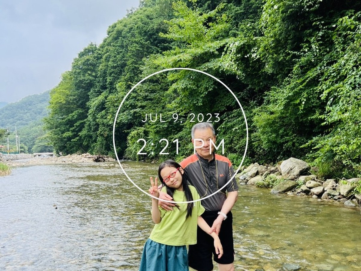
Yongheungsa Valley
Yongheungsa Valley suits anyone who wants to capture the coolness and texture of a summer valley. The core scene layers broad rocks, flowing water and forest shade, giving a different kind of valley photo from Gamagol Eco Park with its forest trails and Yongso pool. People come here to cool off, so it is best not to photograph their resting spots, and water depth and slippery rocks vary from spot to spot.
주소 전라남도 담양군 월산면 용흥리 일대
촬영 포인트 넓은 바위와 흐르는 물, 숲 그늘을 겹치면 여름 계곡의 온도와 질감이 사진에 담긴다.
추천 시간 빛이 강하지 않은 오전
현장 팁 수심과 미끄러운 바위를 확인하고 피서객의 휴식 공간을 촬영하지 않는다.
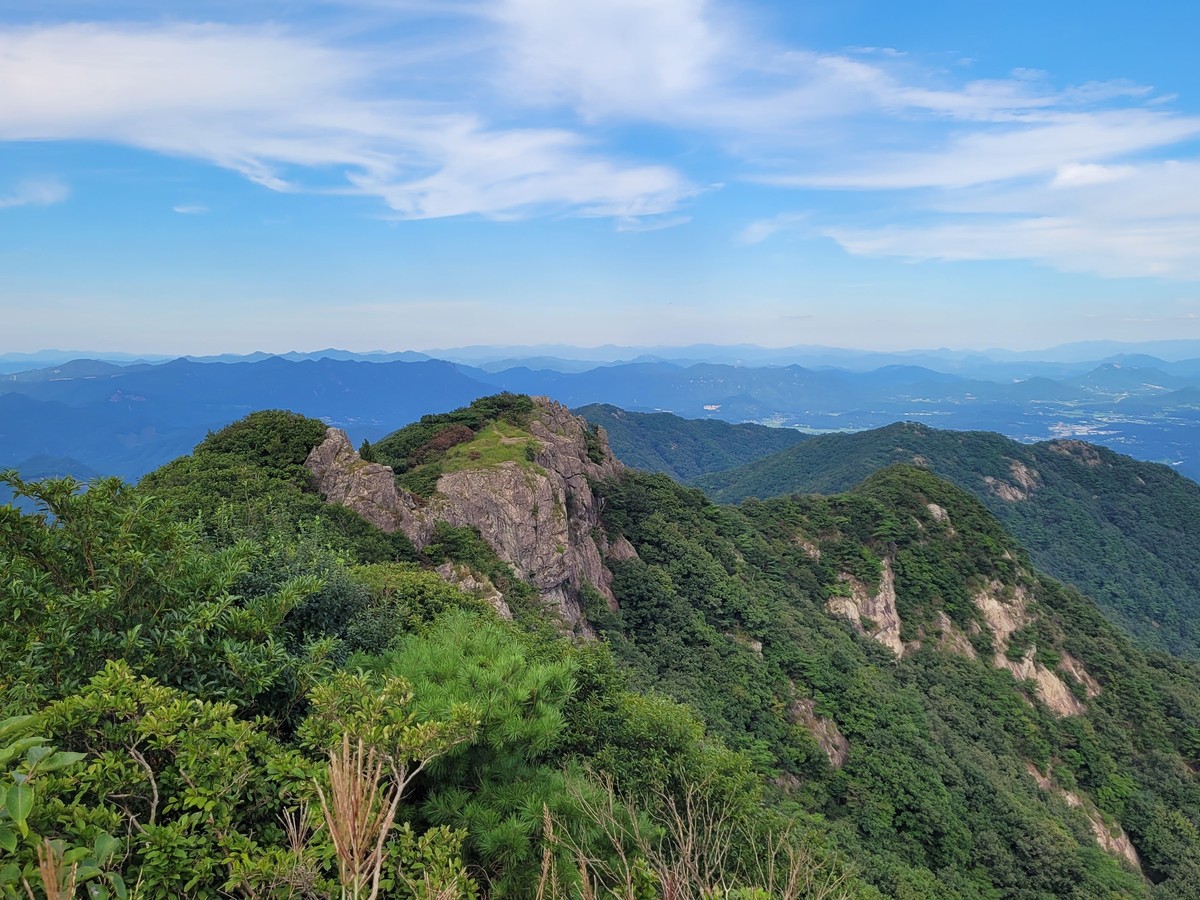
Byeongpungsan
Byeongpungsan suits anyone who wants a mountaintop view spreading over the Damyang plains. Where Chuwolsan shows the contrast of lake and rocky crest, here a ridge running like a folding screen and the plains below trace the broad outline of the mountains in western Damyang. With ridge winds and steep slopes, windproof gear is reassuring, and getting down before sunset requires leaving plenty of time.
주소 전라남도 담양군 수북면 대방리 일대
촬영 포인트 병풍처럼 이어진 능선과 담양 평야를 넓게 담으면 서쪽 산세의 큰 윤곽이 선명해진다.
추천 시간 미세먼지가 적은 오전
현장 팁 능선 바람과 급경사에 대비하고 일몰 전 충분한 하산 시간을 확보한다.
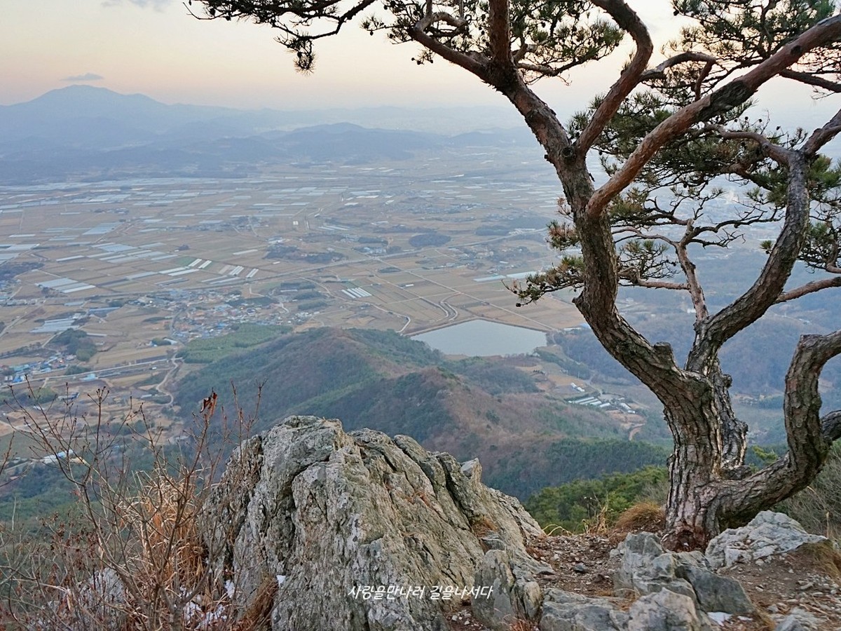
Saminsan
Saminsan suits anyone who wants a view around sunset without a demanding climb. Where Byeongpungsan shows broad plains and big mountain forms, this low mountain offers a view of everyday countryside, with the forest toward the summit and the fields of Daejeon-myeon together. Waiting for the sunset can easily delay your descent, so bring a light and come down only by the official trail.
주소 전라남도 담양군 대전면 행성리 산 55
촬영 포인트 정상 방향 숲과 대전면 들판을 함께 담으면 낮은 산에서 바라보는 생활권 전망이 나타난다.
추천 시간 노을 한 시간 전
현장 팁 정규 등산로를 이용하고 어두워지기 전 하산하거나 조명을 준비한다.
The scenic photos of Damyang come to life much more with a close foreground. By placing deck railings, fortress walls, or tree branches in the foreground, you can separate the lake and ridges into middle and long-distance views. In the valleys, secure a non-slippery position before slowing down your shutter speed, and at the summit, capturing both panoramic and vertical compositions will help you compare height and width.
Weather and access controls are more important than operating hours in the mountains and valleys. Check the water levels at Gamagol and Yongheungsa Valley after heavy rain, the condition of the cliffs on Chuwolsan and Byeongpungsan, and the slippery stone paths of Geumseongsanseong before starting. Preparing for water, wind protection gear, and lighting for descent will allow for a smooth end to your photographic journey.
Weather and access controls are more important than operating hours in the mountains and valleys. Check the water levels at Gamagol and Yongheungsa Valley after heavy rain, the condition of the cliffs on Chuwolsan and Byeongpungsan, and the slippery stone paths of Geumseongsanseong before starting. Preparing for water, wind protection gear, and lighting for descent will allow for a smooth end to your photographic journey.
At a glance
8 items
Locations at a glance
8 places
As part of the Coupang Partners program, this post may earn a commission from qualifying purchases.
Comments 0
Log in to leave a comment.
Be the first to comment.
How about these lists?


You might also like


🎲
Not ready to stop here?
Wondering what to read next is the biggest waste of time.
Let the dice decide — you won't know what pops up until you roll.
If you don't press it… won't you wonder forever? 👀