
Collection
Photography
2026.08.22
Each Island You Cross by Boat Reveals Different Colors of the Sea and Times
Photo Spots Connecting Lighthouses, Coastal Paths, and Small Beaches in Yeosu
Photos of the islands in Yeosu become richer when they capture the port where boats are awaited, the paths passing through forests and villages, and the lighthouses standing at the sea's edge, rather than focusing solely on famous viewpoints. From the accessibility of Odongdo in the city to the cliff paths of Geomodo, the low beaches of Nango and Sado, and further to the distant Geomun Lighthouse, the landscapes and rhythm of travel vary greatly with distance.
This list selects eight actual island locations without counting auxiliary viewpoints or parking areas. Each island has different ferry schedules and stay durations, so they cannot be grouped into a single itinerary, and trips may be canceled depending on the weather. Remember to prepare water and simple meals, respect residents’ living spaces and private lands, and adhere to official paths and return times.
This list selects eight actual island locations without counting auxiliary viewpoints or parking areas. Each island has different ferry schedules and stay durations, so they cannot be grouped into a single itinerary, and trips may be canceled depending on the weather. Remember to prepare water and simple meals, respect residents’ living spaces and private lands, and adhere to official paths and return times.
Odongdo
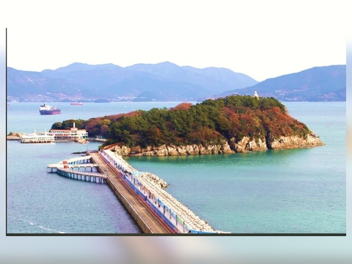
On Odongdo, capture the transformation of the urban island by sequentially photographing the camellia forest path, breakwater, and the sea leading to the island. After capturing wide scenes showing the entire space, also record materials and surfaces up close. The recommended time is on weekday mornings when crowds are fewer and the light is soft. On-site, ensure to check round-trip ferry schedules and potential cancellations while also allowing plenty of time for your return. After shooting, briefly note the access route, direction of light, and conditions affecting the scene, such as tide or ferry schedules. This will help when you return in different seasons to discover new expressions of the location without repeating the same compositions.
주소 전남광주통합특별시 여수시 수정동 1-2
촬영 포인트 동백 숲길과 방파제, 섬으로 이어지는 바다를 순서대로 담아 도심 섬의 변화를 보여준다.
추천 시간 인파가 적고 빛이 부드러운 평일 오전
현장 팁 섬 방문은 왕복 배편과 결항 가능성을 확인하고 귀항 시간을 넉넉히 잡는다.
Geomun Island Lighthouse
Geomun Lighthouse
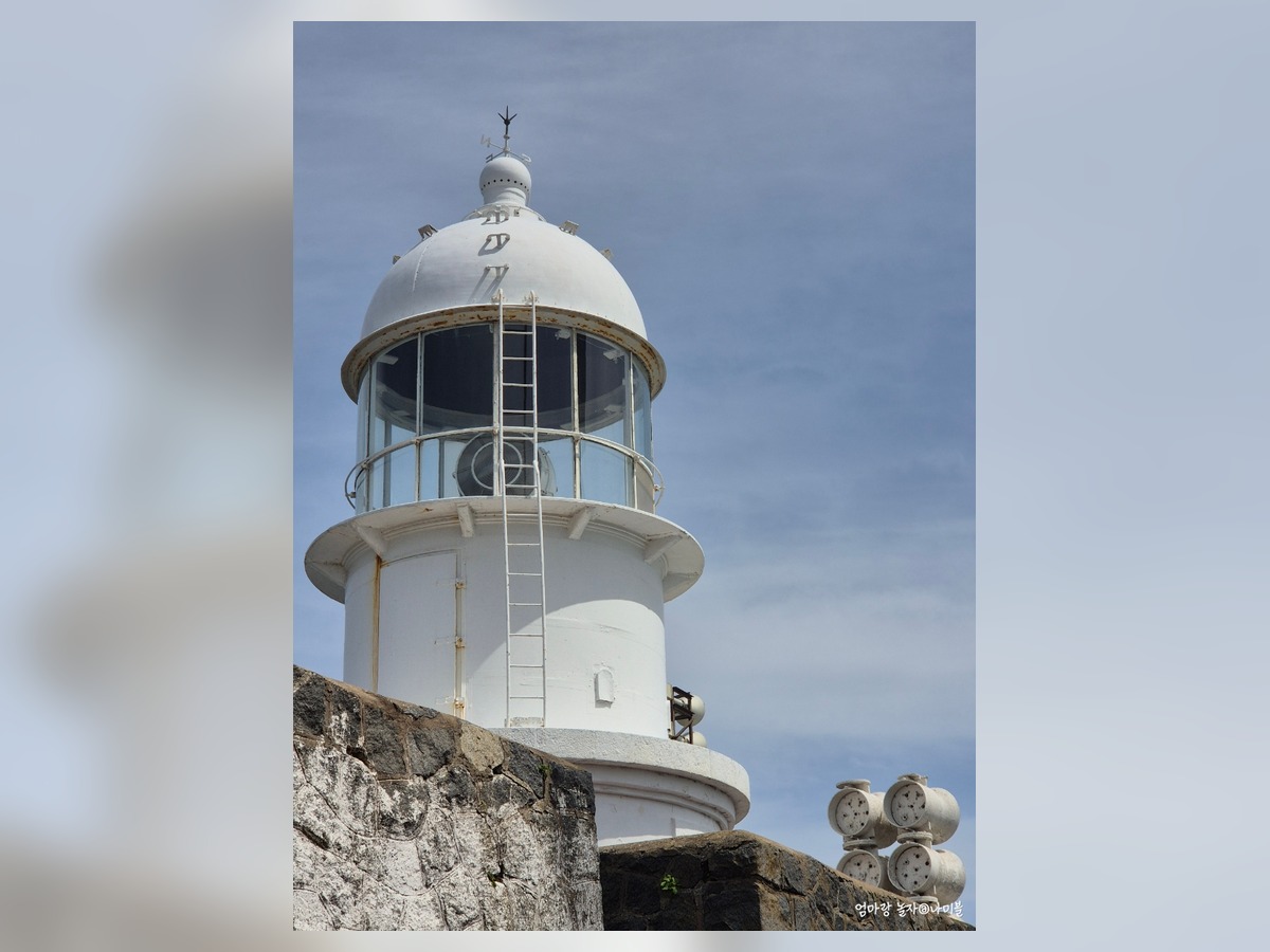
At Geomun Lighthouse, capture the white lighthouse, cliffs, and distant horizon to represent both the isolation and openness of the South Sea. By aligning the grid and settling the horizontals and verticals, the forms of the architecture and paths will be preserved stably. The recommended time is during the morning when shapes and colors are distinct with even light. Check tide levels, strong winds, and slippery rocks on-site and shoot safely within the limits. After shooting, briefly note the access route, direction of light, and conditions impacting the scene, such as tide or ferry schedules. This will help when you return in different seasons to discover new expressions of the location without repeating the same compositions.
주소 전남광주통합특별시 여수시 삼산면 거문도등대길 299
촬영 포인트 흰 등대와 절벽, 먼 수평선을 넓게 배치해 남해 외해의 고립감과 개방감을 함께 표현한다.
추천 시간 형태와 색이 또렷한 오전의 고른 빛
현장 팁 해안에서는 물때와 강풍, 미끄러운 바위를 확인하고 안전선 안에서 촬영한다.
Baekyado Lighthouse Management Office
Baekyado Beacon Management Office
At Baekyado Beacon Management Office, overlap the low white lighthouse and the sea towards Baekyado Bridge to document a tidy landscape at the island's gateway. Moving a few steps away from the background will reveal the scale of the place without hiding the lines of the landscape. The recommended time is in the late afternoon when shadows grow longer. On-site, check the operating hours and internal photography rules of cultural facilities and temples. After shooting, briefly note the access route, direction of light, and conditions impacting the scene, such as tide or ferry schedules. This will help when you return in different seasons to discover new expressions of the location without repeating the same compositions.
주소 전남광주통합특별시 여수시 화정면 백야등대길 48
촬영 포인트 낮은 흰 등대와 백야대교 방향 바다를 겹쳐 섬 관문의 단정한 풍경을 기록한다.
추천 시간 그림자가 길어지는 늦은 오후
현장 팁 문화시설과 사찰은 운영시간과 내부 촬영 규정을 현장에서 확인한다.
Geumo Island Cliff Trail
Geomodo Coastal Path
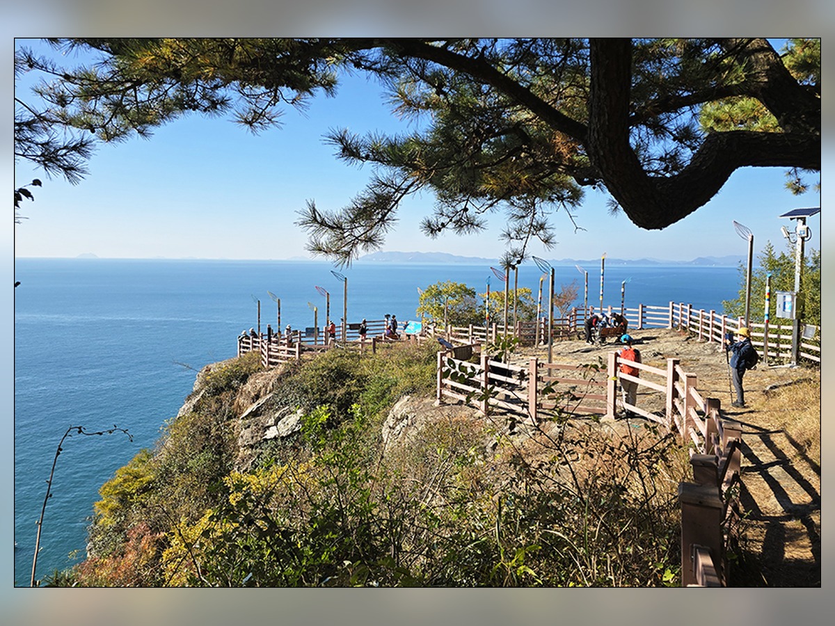
The coastal path on Geomodo captures the curvature of the road along the cliffs and the sea below, highlighting the height of the coastal topography. Trying both frontal and angled compositions in sequence allows for the most natural expression of spatial depth. The recommended time is from one hour before sunset until just after the sun has set. On-site, respect privacy when subjects can be identified and don’t obstruct traffic with a tripod. After shooting, briefly note the access route, direction of light, and conditions impacting the scene, such as tide or ferry schedules. This will help when you return in different seasons to discover new expressions of the location without repeating the same compositions.
주소 전남광주통합특별시 여수시 남면 유송리
촬영 포인트 절벽을 따라 휘어진 길과 아래 바다를 함께 담아 금오도 해안 지형의 높이를 살린다.
추천 시간 일몰 한 시간 전부터 해가 진 직후
현장 팁 인물이 식별될 때는 초상권을 배려하고 삼각대로 통행을 막지 않는다.
Nangdo Beach
Nango Beach
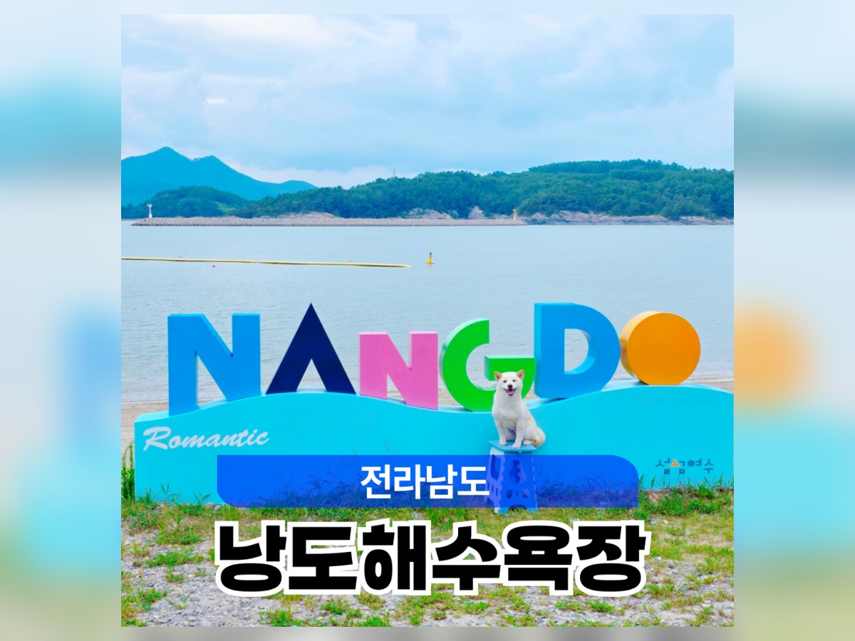
At Nango Beach, showcase the calm bay, sandy shore, and rooftops of the village layered together to reflect life on Nango's beach. When the light is strong, match the exposure for bright areas and adjust the shadows without excessive correction. The recommended time is after the rain, when the air has cleared. On-site, use official lit walking paths at night and do not stand outside the railings or on the road. After shooting, briefly note the access route, direction of light, and conditions impacting the scene, such as tide or ferry schedules. This will help when you return in different seasons to discover new expressions of the location without repeating the same compositions.
주소 전남광주통합특별시 여수시 화정면 여산길 142-20
촬영 포인트 잔잔한 만과 모래사장, 마을 지붕을 층으로 나눠 낭도의 생활 해변을 보여준다.
추천 시간 비가 그친 뒤 공기가 맑아진 시간
현장 팁 야간에는 밝은 공식 산책로를 이용하고 난간 밖이나 차도에 서지 않는다.
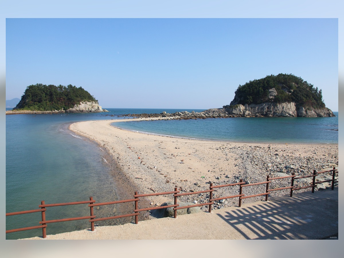
Sado Beach
At Sado Beach, connect the island's rocks known for dinosaur footprints, the beach, and adjacent islands from a low viewpoint. It's advisable to first locate potential foreground elements and slowly adjust their positions overlapping with the background. The recommended time is right after opening, when natural light is abundant. On-site, maintain a respectful distance from wildlife and do not leave food or trash in ecological spaces. After shooting, briefly note the access route, direction of light, and conditions impacting the scene, such as tide or ferry schedules. This will help when you return in different seasons to discover new expressions of the location without repeating the same compositions.
주소 전남광주통합특별시 여수시 화정면 낭도리
촬영 포인트 공룡 발자국으로 알려진 섬의 바위와 해변, 인접 섬을 낮은 시선으로 연결한다.
추천 시간 개방 직후 자연광이 충분한 시간
현장 팁 생태 공간에서는 야생동물과 거리를 두고 먹이나 쓰레기를 남기지 않는다.
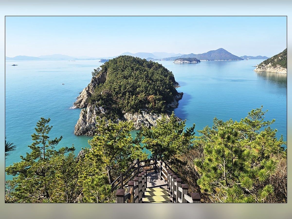
Hahwa Island Flower Path
Hawhado Flower Island Path
On the Hawhado Flower Island Path, include the curves of the flower path, stone walls, and blue sea to capture the seasonal feeling of this small island walk. Alternating between eye-level and low perspectives will express the depth of the paths and structures differently. The recommended time is during bright days when ferry schedules and tide levels have been confirmed. On-site, check the parking and public transport last trips in advance and stick to official walking paths. After shooting, briefly note the access route, direction of light, and conditions impacting the scene, such as tide or ferry schedules. This will help when you return in different seasons to discover new expressions of the location without repeating the same compositions.
주소 전남광주통합특별시 여수시 화정면 하화리 340-2
촬영 포인트 꽃길의 곡선과 돌담, 푸른 바다를 함께 넣어 작은 섬 산책길의 계절감을 담는다.
추천 시간 배편과 물때를 확인한 밝은 낮
현장 팁 주차와 대중교통 막차를 미리 확인하고 공식 보행로만 이용한다.
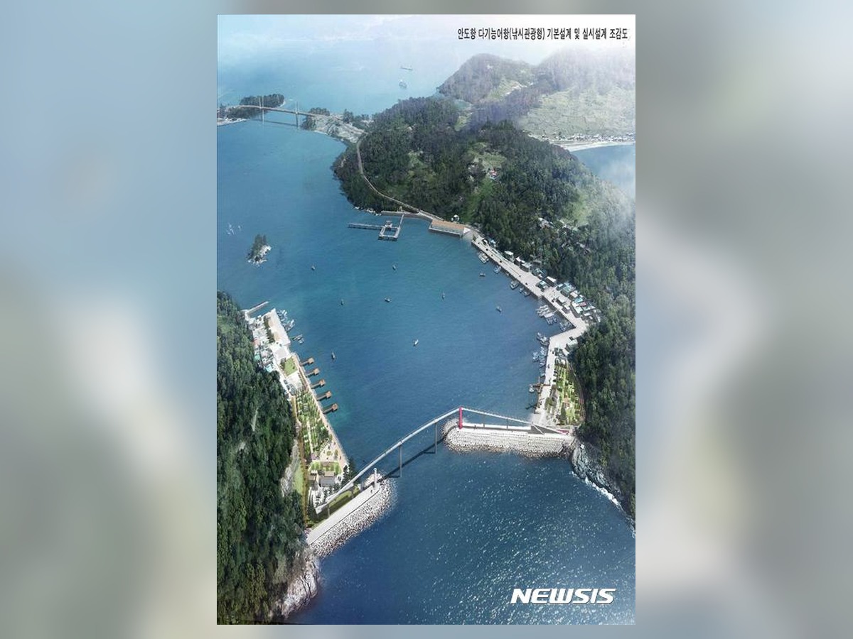
Ando Port
At Ando Port, layer the breakwater, fishing boats, and low roofs of Ando village to document the daily life of the island’s port. Adding images of landmarks and access paths to representative landscapes creates helpful records for future visits. The recommended time is from dusk until just after sunset when lights come on. On-site, do not disturb port work vehicles or the living paths of residents and avoid entering restricted areas. After shooting, briefly note the access route, direction of light, and conditions impacting the scene, such as tide or ferry schedules. This will help when you return in different seasons to discover new expressions of the location without repeating the same compositions.
주소 전남광주통합특별시 여수시 남면 안도리
촬영 포인트 방파제와 어선, 안도 마을의 낮은 지붕을 겹쳐 섬 항구의 일상을 기록한다.
추천 시간 조명이 켜지는 해 질 무렵부터 초저녁
현장 팁 항구 작업 차량과 주민의 생활 동선을 방해하지 않고 통제 구역에 들어가지 않는다.
Upon arriving on an island, instead of immediately seeking the main scene, take the time to observe the changes in the pier, village roads, and forests. Recording the path to the lighthouse and the contours of the beach will reveal the island's size and orientation. A telephoto lens helps compress distant islands and lighthouses, while a wide-angle lens is useful for showcasing cliff paths and the height of the sea.
Odongdo is accessible by land, but for other islands, ferry schedules and weather conditions are key. It's more practical to arrange separate itineraries for Geomodo, Ando, Nango, Sado, and Hawhado. Allow extra time so you’re not rushed to shoot before the last ferry, and prioritize the quiet lives of villagers and the safety of the walking paths. Checking the latest operational information and weather before visiting will give you more time to consider compositions on-site.
Odongdo is accessible by land, but for other islands, ferry schedules and weather conditions are key. It's more practical to arrange separate itineraries for Geomodo, Ando, Nango, Sado, and Hawhado. Allow extra time so you’re not rushed to shoot before the last ferry, and prioritize the quiet lives of villagers and the safety of the walking paths. Checking the latest operational information and weather before visiting will give you more time to consider compositions on-site.
한눈에 보기
8개
Odongdo
전남광주통합특별시 여수시 수정동 1-2 · 동백 숲길과 방파제, 섬으로 이어지는 바다를 순서대로 담아 도심 섬의 변화를 보여준다. · 인파가 적고 빛이 부드러운 평일 오전 · 섬 방문은 왕복 배편과 결항 가능성을 확인하고 귀항 시간을 넉넉히 잡는다.
Geomun Island Lighthouse
전남광주통합특별시 여수시 삼산면 거문도등대길 299 · 흰 등대와 절벽, 먼 수평선을 넓게 배치해 남해 외해의 고립감과 개방감을 함께 표현한다. · 형태와 색이 또렷한 오전의 고른 빛 · 해안에서는 물때와 강풍, 미끄러운 바위를 확인하고 안전선 안에서 촬영한다.
Baekyado Lighthouse Management Office
전남광주통합특별시 여수시 화정면 백야등대길 48 · 낮은 흰 등대와 백야대교 방향 바다를 겹쳐 섬 관문의 단정한 풍경을 기록한다. · 그림자가 길어지는 늦은 오후 · 문화시설과 사찰은 운영시간과 내부 촬영 규정을 현장에서 확인한다.
Geumo Island Cliff Trail
전남광주통합특별시 여수시 남면 유송리 · 절벽을 따라 휘어진 길과 아래 바다를 함께 담아 금오도 해안 지형의 높이를 살린다. · 일몰 한 시간 전부터 해가 진 직후 · 인물이 식별될 때는 초상권을 배려하고 삼각대로 통행을 막지 않는다.
Nangdo Beach
전남광주통합특별시 여수시 화정면 여산길 142-20 · 잔잔한 만과 모래사장, 마을 지붕을 층으로 나눠 낭도의 생활 해변을 보여준다. · 비가 그친 뒤 공기가 맑아진 시간 · 야간에는 밝은 공식 산책로를 이용하고 난간 밖이나 차도에 서지 않는다.
Sado Beach
전남광주통합특별시 여수시 화정면 낭도리 · 공룡 발자국으로 알려진 섬의 바위와 해변, 인접 섬을 낮은 시선으로 연결한다. · 개방 직후 자연광이 충분한 시간 · 생태 공간에서는 야생동물과 거리를 두고 먹이나 쓰레기를 남기지 않는다.
Hahwa Island Flower Path
전남광주통합특별시 여수시 화정면 하화리 340-2 · 꽃길의 곡선과 돌담, 푸른 바다를 함께 넣어 작은 섬 산책길의 계절감을 담는다. · 배편과 물때를 확인한 밝은 낮 · 주차와 대중교통 막차를 미리 확인하고 공식 보행로만 이용한다.
Ando Port
전남광주통합특별시 여수시 남면 안도리 · 방파제와 어선, 안도 마을의 낮은 지붕을 겹쳐 섬 항구의 일상을 기록한다. · 조명이 켜지는 해 질 무렵부터 초저녁 · 항구 작업 차량과 주민의 생활 동선을 방해하지 않고 통제 구역에 들어가지 않는다.
위치 한눈에 보기
8곳
이 포스팅은 쿠팡 파트너스 활동의 일환으로, 이에 따른 일정액의 수수료를 제공받습니다.
댓글 0
로그인 후 댓글을 작성할 수 있습니다.
첫 댓글을 남겨보세요.
이런 리스트는 어때요?


이런 리스트도 추천해요


🎲
여기서 멈추기엔 아쉽잖아?
다음에 뭘 볼지 고민하는 시간이 제일 아까워.
주사위가 대신 골라줄게 — 무슨 리스트가 튀어나올지는 굴려봐야 알지.
안 누르면… 평생 궁금하지 않겠어? 👀
