
Collection
Singapore Travel
2026.08.26
The Wild Side of Sentosa Behind the Amusement Facilities
A Real Nature Observation Spot Following Forests, Waterfalls, and Coastal Ecosystems
Behind the vibrant amusement facilities of Sentosa, there are secondary forests, coastal woodlands, rocky shores, and small freshwater habitats. At Mount Imbiah, you can observe ancient trees, birds, and dragonflies, while the northern Coastal Trail showcases the transition between forests and the sea. This list focuses on spots that help you understand real ecology and landscapes rather than landscaped photo zones.
In natural areas, you should not stray from designated paths and must not touch or feed wildlife. It can get hot and there may be mosquitoes, so it's best to start in the morning and prepare water, insect repellent, and non-slip shoes. Places like Tanjong Rimau, where tides and safety controls are crucial, should only be accessed through official programs or guides rather than freely visiting.
In natural areas, you should not stray from designated paths and must not touch or feed wildlife. It can get hot and there may be mosquitoes, so it's best to start in the morning and prepare water, insect repellent, and non-slip shoes. Places like Tanjong Rimau, where tides and safety controls are crucial, should only be accessed through official programs or guides rather than freely visiting.
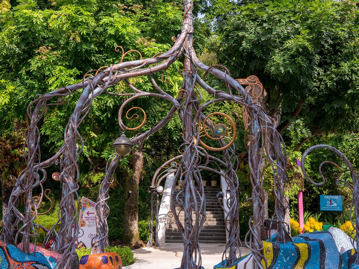
Sentosa Nature Discovery
This free natural gallery explains the island's eight habitats, geology, and flora and fauna through exhibits and interactive displays. It’s a great place to familiarize yourself with observation criteria before walking on the forest trails. It serves as a starting point that connects indoor learning and real-life nature exploration.
Head towards Imbiah Lookout from Imbiah Station. First, decide on an area of interest between the Geology Gallery and Habitat Gallery. Check the last entry and whether workshops require reservations. Even though Sentosa's forests, coast, and resorts are close, actual travel times can be prolonged due to slopes and detours. Calculate your reservation time along with your next destination and prioritize onsite guides and indications. As operating hours, menus, entry limits, and experience restrictions may change, be sure to check the official page again on the day of your visit. The coordinates are based on WGS84, and the main access points have been used for areas with extensive walking paths or complex facilities.
Head towards Imbiah Lookout from Imbiah Station. First, decide on an area of interest between the Geology Gallery and Habitat Gallery. Check the last entry and whether workshops require reservations. Even though Sentosa's forests, coast, and resorts are close, actual travel times can be prolonged due to slopes and detours. Calculate your reservation time along with your next destination and prioritize onsite guides and indications. As operating hours, menus, entry limits, and experience restrictions may change, be sure to check the official page again on the day of your visit. The coordinates are based on WGS84, and the main access points have been used for areas with extensive walking paths or complex facilities.
주소 51 Imbiah Road, Singapore 099702
공식 안내 https://www.sentosa.com.sg/en/things-to-do/attractions/sentosa-nature-discovery/
방문 팁 Geology Gallery와 Habitat Gallery 중 관심 구역을 먼저 정하자.
Mount Imbia Nature Trail
Mount Imbiah Nature Trail
This natural trail passes through secondary forests formed on the hills that used to have old fortifications. Observe ancient trees, freshwater environments, and various birds and insects while experiencing the forests in the center of Sentosa. It is close to the resort area yet allows you to feel the density of the forest.
Enter from the official entrance towards either Imbiah Lookout or Siloso Road. Check the signs at the crossroads and exit the trail before sunset. The slopes and tree roots can be slippery after rain. Even though Sentosa's forests, coast, and resorts are close, actual travel times can be prolonged due to slopes and detours. Calculate your reservation time along with your next destination and prioritize onsite guides and indications. As operating hours, menus, entry limits, and experience restrictions may change, be sure to check the official page again on the day of your visit. The coordinates are based on WGS84, and the main access points have been used for areas with extensive walking paths or complex facilities.
Enter from the official entrance towards either Imbiah Lookout or Siloso Road. Check the signs at the crossroads and exit the trail before sunset. The slopes and tree roots can be slippery after rain. Even though Sentosa's forests, coast, and resorts are close, actual travel times can be prolonged due to slopes and detours. Calculate your reservation time along with your next destination and prioritize onsite guides and indications. As operating hours, menus, entry limits, and experience restrictions may change, be sure to check the official page again on the day of your visit. The coordinates are based on WGS84, and the main access points have been used for areas with extensive walking paths or complex facilities.
주소 Imbiah Road, Singapore 099702
공식 안내 https://www.sentosa.com.sg/en/get-inspired/sentosa-guides/discovering-nature-on-sentosa/
방문 팁 갈림길 표지를 확인하고 해 지기 전에 트레일을 빠져나오자.
Sentosa Coastal Trail
This path shows the transformation of secondary forests into coastal woodlands and rocky and sandy shores to the north of Mount Imbiah. It depicts different coastal landscapes compared to the busy southern beaches. It is a good spot to understand the connection between the forest and intertidal zones in a short distance.
Walk only along permitted areas following Siloso Point and the official trail signs. Check for tide conditions and any construction controls, and do not go down under the rocks. Avoid access to the coast outside of controlled zones. Even though Sentosa's forests, coast, and resorts are close, actual travel times can be prolonged due to slopes and detours. Calculate your reservation time along with your next destination and prioritize onsite guides and indications. As operating hours, menus, entry limits, and experience restrictions may change, be sure to check the official page again on the day of your visit. The coordinates are based on WGS84, and the main access points have been used for areas with extensive walking paths or complex facilities.
Walk only along permitted areas following Siloso Point and the official trail signs. Check for tide conditions and any construction controls, and do not go down under the rocks. Avoid access to the coast outside of controlled zones. Even though Sentosa's forests, coast, and resorts are close, actual travel times can be prolonged due to slopes and detours. Calculate your reservation time along with your next destination and prioritize onsite guides and indications. As operating hours, menus, entry limits, and experience restrictions may change, be sure to check the official page again on the day of your visit. The coordinates are based on WGS84, and the main access points have been used for areas with extensive walking paths or complex facilities.
주소 North coast of Mount Imbiah, Singapore
공식 안내 https://www.sentosa.com.sg/en/get-inspired/sentosa-guides/discovering-nature-on-sentosa/
방문 팁 조수와 공사 통제 여부를 확인하고 바위 아래로 내려가지 말자.
Tanjong Rimau
A conservation area on the northwestern tip of Sentosa showcasing sandstone layers, intertidal zones, and coastal woods. It is not a place for free swimming like a regular beach. You can deeply explore the island's geological formation and marine ecology through official nature programs.
Follow the gathering and access instructions of the official guide program. Check if there are authorized tours before entering individually. Always adhere to tide, rock fall, and slippery hazards, as well as controlled zones. Even though Sentosa's forests, coast, and resorts are close, actual travel times can be prolonged due to slopes and detours. Calculate your reservation time along with your next destination and prioritize onsite guides and indications. As operating hours, menus, entry limits, and experience restrictions may change, be sure to check the official page again on the day of your visit. The coordinates are based on WGS84, and the main access points have been used for areas with extensive walking paths or complex facilities.
Follow the gathering and access instructions of the official guide program. Check if there are authorized tours before entering individually. Always adhere to tide, rock fall, and slippery hazards, as well as controlled zones. Even though Sentosa's forests, coast, and resorts are close, actual travel times can be prolonged due to slopes and detours. Calculate your reservation time along with your next destination and prioritize onsite guides and indications. As operating hours, menus, entry limits, and experience restrictions may change, be sure to check the official page again on the day of your visit. The coordinates are based on WGS84, and the main access points have been used for areas with extensive walking paths or complex facilities.
주소 Western tip of Sentosa, Singapore
공식 안내 https://www.sentosa.com.sg/en/get-inspired/sentosa-guides/sustainable-tourism/
방문 팁 개별 진입보다 허가된 투어가 열리는지 먼저 확인하자.
Imbiah Waterfall
Imbiah Falls
A small water feature within the Mount Imbiah forest trail where you can observe conditions under which dragonflies and amphibians thrive around freshwater environments. It is closer to an ecological feature of the trail than a large natural waterfall. Slow down mid-trail to look at this small habitat as a reference point.
Approach following the official signage of the Mount Imbiah Nature Trail. Quietly observe the small movements around the leaves and water's edge rather than the grand scene. Do not go beyond the railing or step on wet rocks. Even though Sentosa's forests, coast, and resorts are close, actual travel times can be prolonged due to slopes and detours. Calculate your reservation time along with your next destination and prioritize onsite guides and indications. As operating hours, menus, entry limits, and experience restrictions may change, be sure to check the official page again on the day of your visit. The coordinates are based on WGS84, and the main access points have been used for areas with extensive walking paths or complex facilities.
Approach following the official signage of the Mount Imbiah Nature Trail. Quietly observe the small movements around the leaves and water's edge rather than the grand scene. Do not go beyond the railing or step on wet rocks. Even though Sentosa's forests, coast, and resorts are close, actual travel times can be prolonged due to slopes and detours. Calculate your reservation time along with your next destination and prioritize onsite guides and indications. As operating hours, menus, entry limits, and experience restrictions may change, be sure to check the official page again on the day of your visit. The coordinates are based on WGS84, and the main access points have been used for areas with extensive walking paths or complex facilities.
주소 Imbiah Trail, Singapore 099702
공식 안내 https://www.sentosa.com.sg/en/get-inspired/sentosa-guides/discovering-nature-on-sentosa/
방문 팁 큰 장면보다 주변 잎과 물가의 작은 움직임을 조용히 살펴보자.
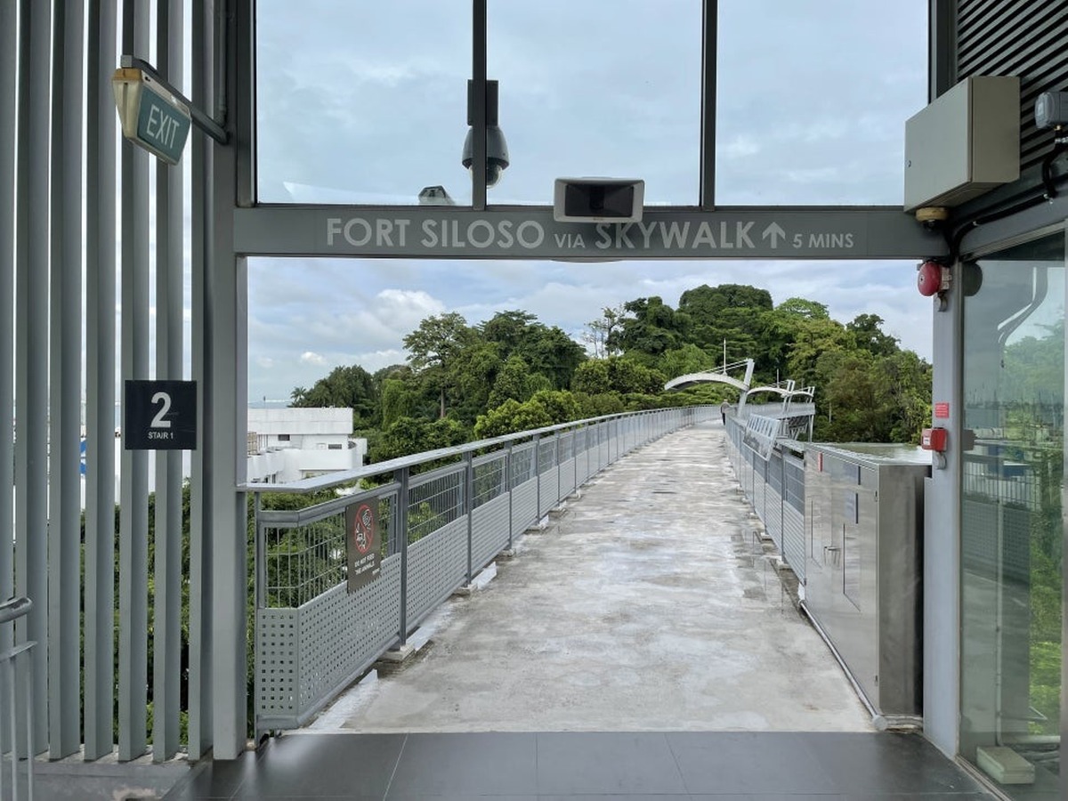
Fort Siloso Skywalk
A free facility with a high pedestrian bridge and observation tower overlooking the eastern canopy, harbor, and strait of Sentosa. It allows for the reading of the terrain from a high point without damaging the forest. It is an easy viewpoint to observe both nature and historical landscapes simultaneously.
Head up via the elevator or stairs from Siloso Point. Observe the canopy and birds more in the morning or late afternoon rather than midday. Immediately come down from high structures during lightning or strong winds. Even though Sentosa's forests, coast, and resorts are close, actual travel times can be prolonged due to slopes and detours. Calculate your reservation time along with your next destination and prioritize onsite guides and indications. As operating hours, menus, entry limits, and experience restrictions may change, be sure to check the official page again on the day of your visit. The coordinates are based on WGS84, and the main access points have been used for areas with extensive walking paths or complex facilities.
Head up via the elevator or stairs from Siloso Point. Observe the canopy and birds more in the morning or late afternoon rather than midday. Immediately come down from high structures during lightning or strong winds. Even though Sentosa's forests, coast, and resorts are close, actual travel times can be prolonged due to slopes and detours. Calculate your reservation time along with your next destination and prioritize onsite guides and indications. As operating hours, menus, entry limits, and experience restrictions may change, be sure to check the official page again on the day of your visit. The coordinates are based on WGS84, and the main access points have been used for areas with extensive walking paths or complex facilities.
주소 Fort Siloso, Singapore 099981
공식 안내 https://www.sentosa.com.sg/en/things-to-do/attractions/fort-siloso-skywalk/
방문 팁 한낮보다 오전이나 늦은 오후에 수관과 새를 관찰하자.
After viewing an overview of the island's geology and habitats at Sentosa Nature Discovery, taking a walk on the Mount Imbiah Nature Trail will allow you to spot more observation targets. Imbiah Falls serves as a short rest point, while the Coastal Trail lets you experience the transition between forests and the coast. The Fort Siloso Skywalk provides a high viewpoint of the canopy and harbor, and Tanjong Rimau offers options to understand the ecology of rocky shores and intertidal zones through guided programs.
You don't need to connect all locations in one day just because you're looking at nature. After rain, roots and stones can be slippery, and if sudden thunder occurs, it's best to immediately leave high vantage points and coastal areas. Walking quietly and observing small sounds and movements will reveal a different character of Sentosa that is hard to understand from just the amusement park and beaches.
You don't need to connect all locations in one day just because you're looking at nature. After rain, roots and stones can be slippery, and if sudden thunder occurs, it's best to immediately leave high vantage points and coastal areas. Walking quietly and observing small sounds and movements will reveal a different character of Sentosa that is hard to understand from just the amusement park and beaches.
한눈에 보기
6개
Sentosa Nature Discovery
51 Imbiah Road, Singapore 099702 · https://www.sentosa.com.sg/en/things-to-do/attractions/sentosa-nature-discovery/ · Geology Gallery와 Habitat Gallery 중 관심 구역을 먼저 정하자.
Mount Imbia Nature Trail
Imbiah Road, Singapore 099702 · https://www.sentosa.com.sg/en/get-inspired/sentosa-guides/discovering-nature-on-sentosa/ · 갈림길 표지를 확인하고 해 지기 전에 트레일을 빠져나오자.
Sentosa Coastal Trail
North coast of Mount Imbiah, Singapore · https://www.sentosa.com.sg/en/get-inspired/sentosa-guides/discovering-nature-on-sentosa/ · 조수와 공사 통제 여부를 확인하고 바위 아래로 내려가지 말자.
Tanjong Rimau
Western tip of Sentosa, Singapore · https://www.sentosa.com.sg/en/get-inspired/sentosa-guides/sustainable-tourism/ · 개별 진입보다 허가된 투어가 열리는지 먼저 확인하자.
Imbiah Waterfall
Imbiah Trail, Singapore 099702 · https://www.sentosa.com.sg/en/get-inspired/sentosa-guides/discovering-nature-on-sentosa/ · 큰 장면보다 주변 잎과 물가의 작은 움직임을 조용히 살펴보자.
Fort Siloso Skywalk
Fort Siloso, Singapore 099981 · https://www.sentosa.com.sg/en/things-to-do/attractions/fort-siloso-skywalk/ · 한낮보다 오전이나 늦은 오후에 수관과 새를 관찰하자.
위치 한눈에 보기
6곳
이 포스팅은 쿠팡 파트너스 활동의 일환으로, 이에 따른 일정액의 수수료를 제공받습니다.
댓글 0
로그인 후 댓글을 작성할 수 있습니다.
첫 댓글을 남겨보세요.
이런 리스트는 어때요?


이런 리스트도 추천해요



🎲
여기서 멈추기엔 아쉽잖아?
다음에 뭘 볼지 고민하는 시간이 제일 아까워.
주사위가 대신 골라줄게 — 무슨 리스트가 튀어나올지는 굴려봐야 알지.
안 누르면… 평생 궁금하지 않겠어? 👀
