Collection
Domestic Travel
2026.08.20
As you climb the ridge, the city of Gwacheon unfolds beneath your feet
Photo spots in Gwacheon where you can meet waterfalls and ridges
For mountain and valley photographs in Gwacheon, choose your mountain and return route first. Eight points include the Gwacheon entrance to Gwanaksan, Yeonjudae, Yeonjuam, Munwon Falls, Maebong in the Cheonggyesan area, Maebongsan in Munwon-dong, Yongmagol and Gaengmae Falls.
Similar map names do not establish that two peaks or entrances are the same. Check each location and approach instead of linking all eight into one route. Water flow and visibility depend on rain and weather; choose a manageable visit according to trail restrictions and your own ability.
Similar map names do not establish that two peaks or entrances are the same. Check each location and approach instead of linking all eight into one route. Water flow and visibility depend on rain and weather; choose a manageable visit according to trail restrictions and your own ability.
Gwanaksan Hiking Trail Entrance
Gwanak Mountain Trail Entrance
This Gwanaksan trail entrance is the one in Jungang-dong, Gwacheon. Other areas have entrances with the same name, so match the address first. Rather than summit views, record the start of the wooded path and its signs while deciding the day’s direction.
Continuing to Yeonjudae and walking only a nearby section require different preparation and stamina. Check the route, return path and daylight remaining, and follow closure signs. Take an entrance photograph without obstructing the path, then move aside to prepare for the walk.
Continuing to Yeonjudae and walking only a nearby section require different preparation and stamina. Check the route, return path and daylight remaining, and follow closure signs. Take an entrance photograph without obstructing the path, then move aside to prepare for the walk.
주소 경기 과천시 중앙동 산 9
촬영 포인트 등산로 이정표·숲길이 시작되는 지점
현장 팁 같은 이름의 다른 지역 입구와 구별하고 산행 범위와 귀환 경로를 정하세요.
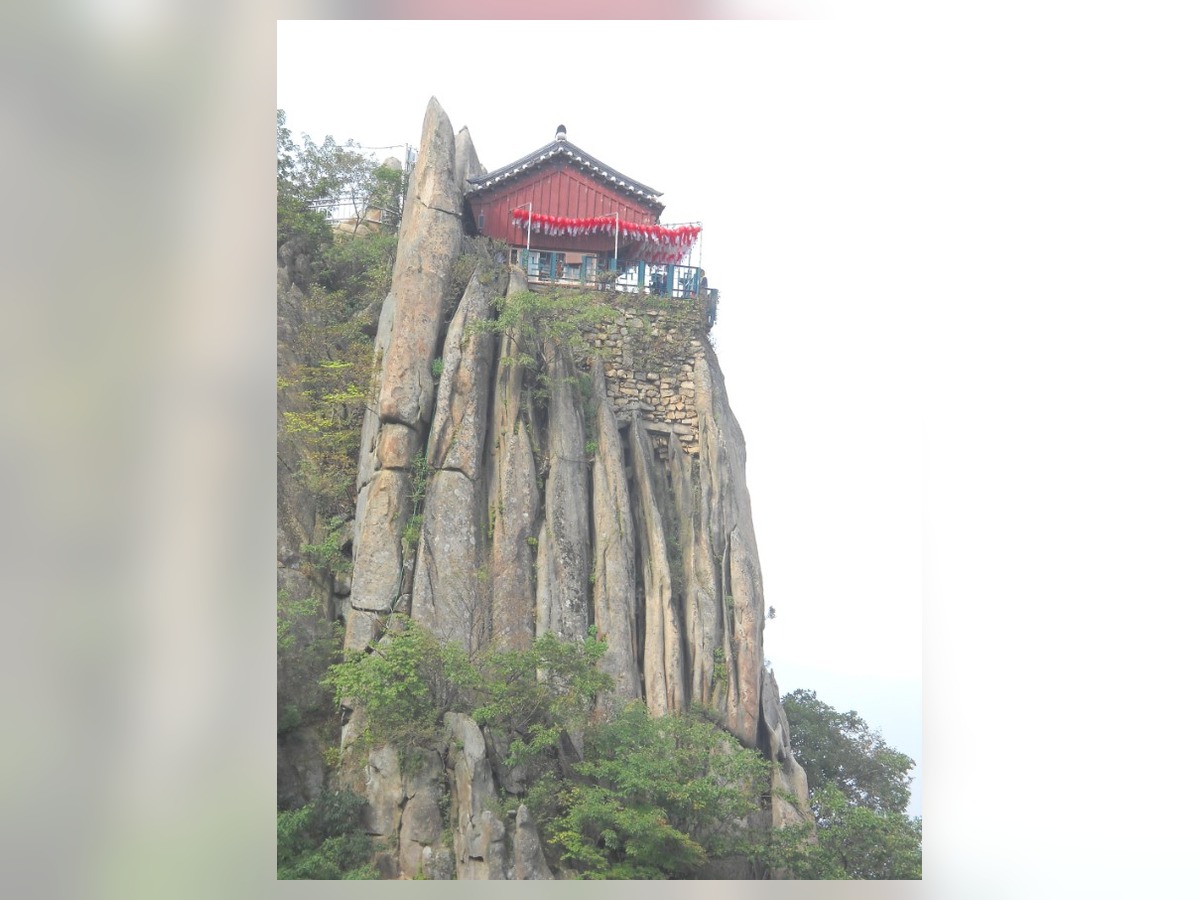
Gwanaksan Yeonjudae
Gwanak Mountain Yeonjudae
Yeonjudae is known for the rock and pavilion near Gwanaksan’s summit. This list treats the rock formation and surrounding ridges as a hiking destination. Viewing from a distance on a designated path can show the relationship between the cliff and pavilion better than moving close to an edge.
Distinguish Yeonjudae from Yeonjuam below it. Wind, wet rock and ice change summit conditions. Do not go beyond railings or attempt difficult rock sections for a photograph. Choose where to stop according to your hiking experience and the time needed to descend.
Distinguish Yeonjudae from Yeonjuam below it. Wind, wet rock and ice change summit conditions. Do not go beyond railings or attempt difficult rock sections for a photograph. Choose where to stop according to your hiking experience and the time needed to descend.
주소 경기 과천시 중앙동
촬영 포인트 정상부 암봉·연주대 전각·주변 능선
현장 팁 연주암과 구분하고 정상부 난간·탐방로 밖으로 나가지 마세요.
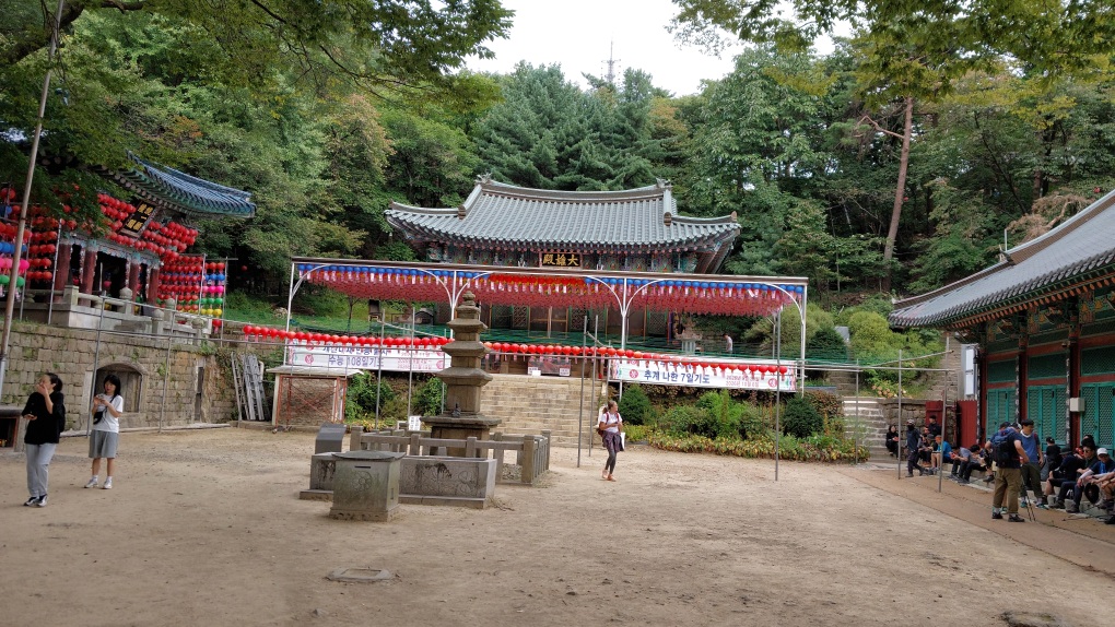
Yeonjuam
Yeonjuam is a Buddhist temple below Yeonjudae on Gwanaksan. Its halls and courtyard are distinct from the small pavilion on the rock at Yeonjudae. Look at rooflines and the arrangement of temple buildings in relation to surrounding paths to record the religious space encountered during a hike.
Do not disturb prayers or worship; ask before photographing inside a hall. Reaching the temple requires a mountain walk, unlike visiting a city cultural facility. Allow a rest stop while retaining enough time and daylight for the remaining descent.
Do not disturb prayers or worship; ask before photographing inside a hall. Reaching the temple requires a mountain walk, unlike visiting a city cultural facility. Allow a rest stop while retaining enough time and daylight for the remaining descent.
주소 경기 과천시 자하동길 63
촬영 포인트 사찰 마당·전각 배치·주변 산길
현장 팁 예불을 방해하지 않도록 촬영하고 하산에 필요한 시간을 남겨두세요.
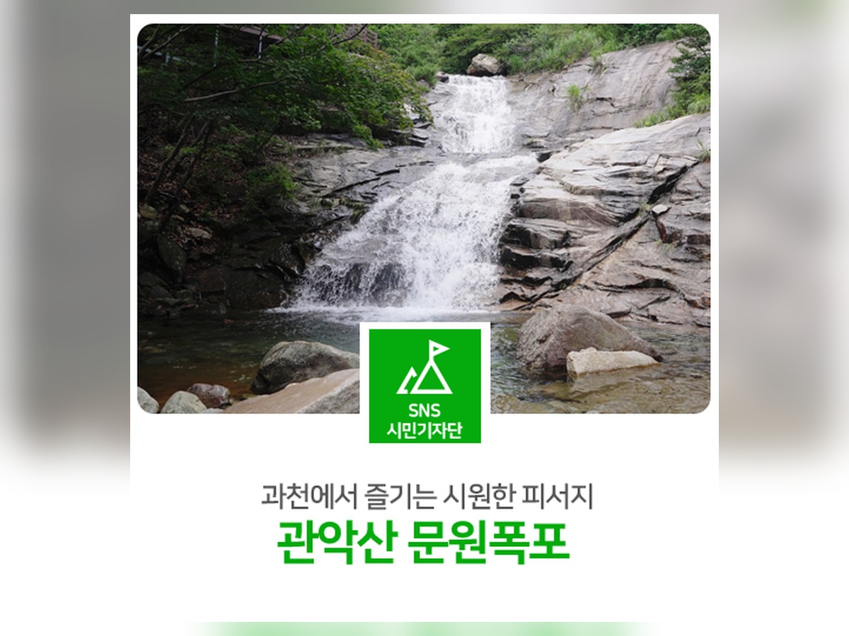
Munwon Falls
Munwon Waterfall
Munwon Falls offers a view of rock and water on Gwanaksan’s mountain paths. Look for a position including surrounding woodland and rock faces rather than isolating the waterfall. Water flow depends on the season and recent rainfall, so a large cascade seen in a photograph is not guaranteed.
Do not enter the stream or step onto wet rock to approach the water. After rain, consider changing water levels and slippery ground and obey restrictions. Choose this as a daytime stop that fits an achievable approach and return, rather than planning photography after sunset.
Do not enter the stream or step onto wet rock to approach the water. After rain, consider changing water levels and slippery ground and obey restrictions. Choose this as a daytime stop that fits an achievable approach and return, rather than planning photography after sunset.
주소 경기 과천시 중앙동 산 11
촬영 포인트 계류·암벽·주변 숲이 이어지는 풍경
현장 팁 수량을 보장하지 않으며 젖은 바위와 계류 진입을 피하세요.
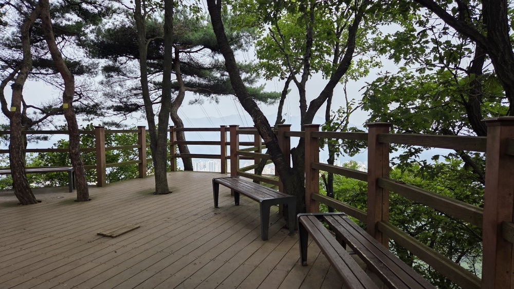
Maebong
This Maebong is the point registered at San 103, Makgye-dong, on the Cheonggyesan side. Other peaks have the same name, so base your hike on the Gwacheon map location. Alternate views of woodland paths and viewing spaces instead of recording only a summit marker.
Check the route rather than treating this point, Maebongsan in Munwon-dong and Maebong toward Seongnam as the same destination. A description as a low mountain does not establish an easy approach. Set a return time and remember that vegetation and weather affect the view.
Check the route rather than treating this point, Maebongsan in Munwon-dong and Maebong toward Seongnam as the same destination. A description as a low mountain does not establish an easy approach. Set a return time and remember that vegetation and weather affect the view.
주소 경기 과천시 막계동 산 103
촬영 포인트 숲길·전망 공간·주변 능선의 관계
현장 팁 과천 막계동 지점과 다른 지역의 동명 봉우리를 지도에서 구별하세요.
Maebongsan
Maebongsan is registered at San 58-11, Munwon-dong, in Gwacheon. Its name resembles Maebong in Makgye-dong, so distinguish the map points and access routes. This entry suggests observing woodland and ridge scenery, without promising the same view from every approach.
Do not assume a level neighborhood-park walk. Identify the official path and return direction first. Where signs are unclear or access is restricted, do not leave the route for photographs. Focus on trees and the path, and choose a distance suited to your ability and time available.
Do not assume a level neighborhood-park walk. Identify the official path and return direction first. Where signs are unclear or access is restricted, do not leave the route for photographs. Focus on trees and the path, and choose a distance suited to your ability and time available.
주소 경기 과천시 문원동 산 58-11
촬영 포인트 문원동 쪽 숲길·능선의 분위기
현장 팁 이름이 비슷한 매봉과 위치를 구별하고 정규 탐방로 안에서 이동하세요.
Yongmagol
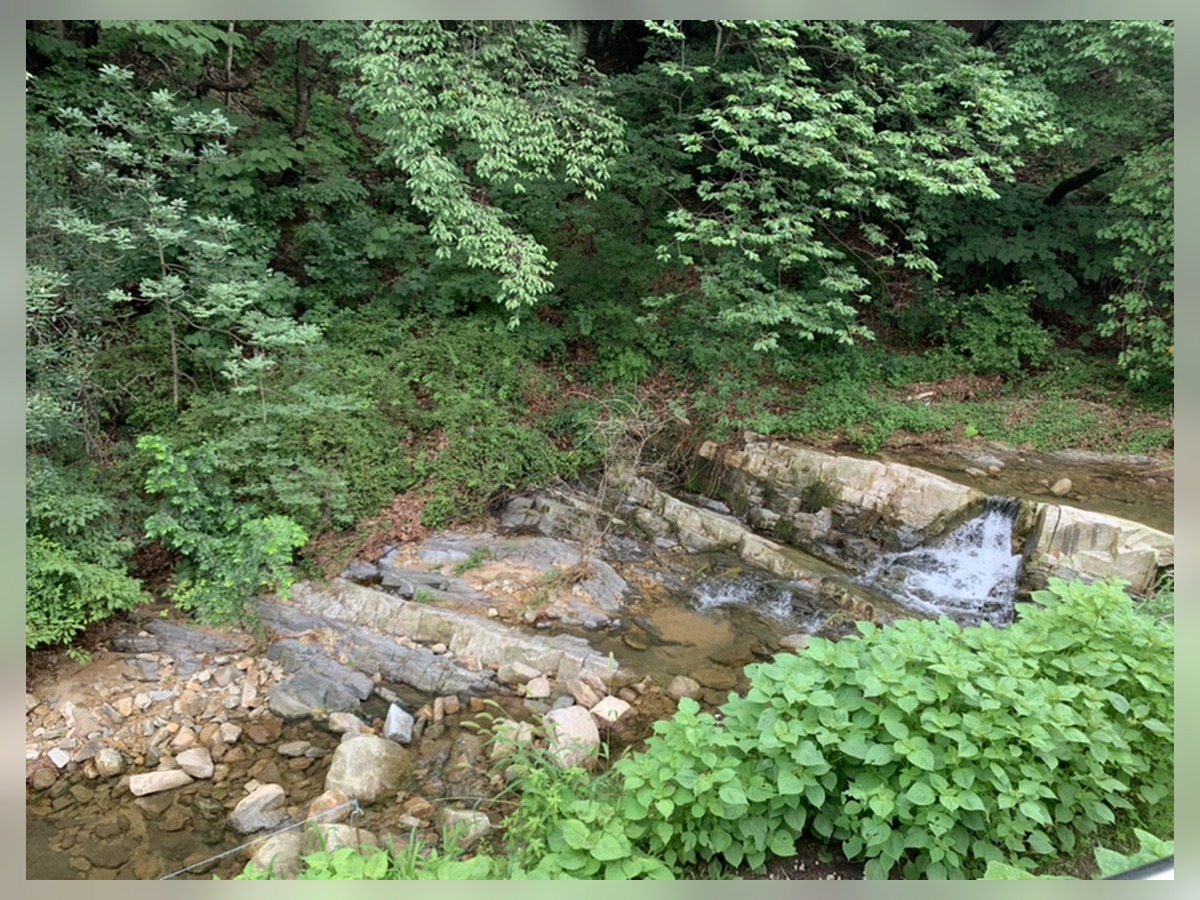
Yongmagol is a valley place name on the Gwanaksan side of Gwacheon-dong. It is included for observing how village streets lead toward the mountain rather than as a summit destination. Wide views can show settlement and hillside together, while closer views can follow bends in the road and seasonal plants.
A map point for a place name is not necessarily a trail entrance. Choose a starting path separately and remain on public routes, respecting homes and private land. If continuing into the mountain, distinguish that from a village walk and set a return time.
A map point for a place name is not necessarily a trail entrance. Choose a starting path separately and remain on public routes, respecting homes and private land. If continuing into the mountain, distinguish that from a village walk and set a return time.
주소 경기 과천시 과천동
촬영 포인트 골짜기의 방향·마을길·산자락의 관계
현장 팁 지명 위치와 실제 탐방로 입구를 구별하고 주민 생활공간을 배려하세요.
Gaengmae Falls
Gengmae Waterfall
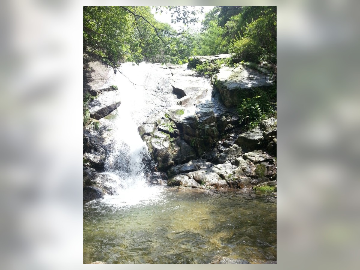
Gaengmae Falls is registered at San 38, Makgye-dong, Gwacheon. It is a different location from Munwon Falls and provides a candidate for stream scenery on the Cheonggyesan side. Observe rock, water and woodland together rather than expecting only a large cascade.
Water flow and ground conditions vary with the visit. Do not cross the stream or descend slippery rock for a close photograph. Remain at accessible viewing positions, postpone an approach during rain or restrictions, and decide whether it fits your walking distance and return route.
Water flow and ground conditions vary with the visit. Do not cross the stream or descend slippery rock for a close photograph. Remain at accessible viewing positions, postpone an approach during rain or restrictions, and decide whether it fits your walking distance and return route.
주소 경기 과천시 막계동 산 38
촬영 포인트 바위 사이 물길·주변 숲·계절에 따른 계류
현장 팁 문원폭포와 위치를 구별하고 계류와 미끄러운 암반에 들어가지 마세요.
Focus on Yeonjudae’s rocks and ridges for views, or Yeonjuam and woodland paths for a different atmosphere. At a waterfall, observe the relationship between water, rock and trees rather than expecting a large cascade.
Stay on designated paths and do not step beyond railings or cross wet rock for a photograph. Distinguish Yeonjudae from Yeonjuam, and Maebong in Makgye-dong from Maebongsan in Munwon-dong. Allow time to descend and change your destination when rain, ice or access restrictions make the approach unsuitable.
Stay on designated paths and do not step beyond railings or cross wet rock for a photograph. Distinguish Yeonjudae from Yeonjuam, and Maebong in Makgye-dong from Maebongsan in Munwon-dong. Allow time to descend and change your destination when rain, ice or access restrictions make the approach unsuitable.
At a glance
8 items
Locations at a glance
8 places
#Shooting Tips#Gwacheon Life Shots#Gwacheon Photo Spots#Gwacheon Travel#Gwanak Mountain and Cheonggye Mountain Views
As part of the Coupang Partners program, this post may earn a commission from qualifying purchases.
Comments 0
Log in to leave a comment.
Be the first to comment.
How about these lists?


You might also like


🎲
Not ready to stop here?
Wondering what to read next is the biggest waste of time.
Let the dice decide — you won't know what pops up until you roll.
If you don't press it… won't you wonder forever? 👀