Collection
Domestic Travel
2026.08.21
Beolgyocheon Flows into Yeojaman Bay, Widening the Landscape of Tidal Flats and Islands
Photo Spots Connecting Ecological Parks, Fishing Ports, and Islands in Beolgyo
The tidal flat of Beolgyo holds a landscape broader than the dish called ggeongguk (shellfish). The Beolgyocheon river flows into the Yeojaman (Yeoja Bay), showcasing reeds, waterways, ecological parks, Beolgyo Bridge, Sangjin Port, and the villages of Hodong and Daepo, even extending to Jangdo in the distance. This reveals how estuaries, agricultural land, fishing ports, and islands form a single living area.
This list selects eight actual tidal flat, fishing port, and island locations. Although the experience center and ecological park are close, their roles are distinct, and Jangdo requires a separate schedule with ferry transport. Be sure to check the tides and weather in advance, and avoid entering protected tidal flat areas or private agricultural land. Prioritize the movements of fishermen and vehicles in the fishing ports. Checking the latest operational information and weather before your visit will give you the time to consider compositions on-site.
This list selects eight actual tidal flat, fishing port, and island locations. Although the experience center and ecological park are close, their roles are distinct, and Jangdo requires a separate schedule with ferry transport. Be sure to check the tides and weather in advance, and avoid entering protected tidal flat areas or private agricultural land. Prioritize the movements of fishermen and vehicles in the fishing ports. Checking the latest operational information and weather before your visit will give you the time to consider compositions on-site.
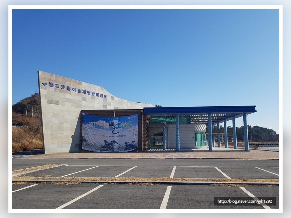
Beolgye Tidal Flat Community Experience Center
Beolgyo Tidal Flat Rural Experience Information Center
The Beolgyo Tidal Flat Rural Experience Information Center captures the scale of the Yeojaman wetland, showcasing the tidal flat waterways and reeds, as well as the surrounding deck of the experience center. After showing a wide view of the entire space, try capturing details of materials and surfaces up close. Recommended times are weekday mornings with soft light and less bustling crowds. On-site, be sure to check tidal schedules for the tidal flats and refrain from entering protected areas and slippery mud. After shooting, record your approach route, light direction, and conditions that influenced the scene such as tide schedules or market days. When you return in other seasons, this will help you discover the new expressions of the place without repeating the same composition.
주소 전남광주통합특별시 보성군 벌교읍 장호길 368
촬영 포인트 갯벌 물길과 갈대, 체험센터 주변 데크를 넓게 담아 여자만 습지의 규모를 보여준다.
추천 시간 빛이 부드럽고 거리가 한산한 평일 오전
현장 팁 갯벌은 물때를 확인하고 보호 구역과 미끄러운 진흙에 무리하게 들어가지 않는다.
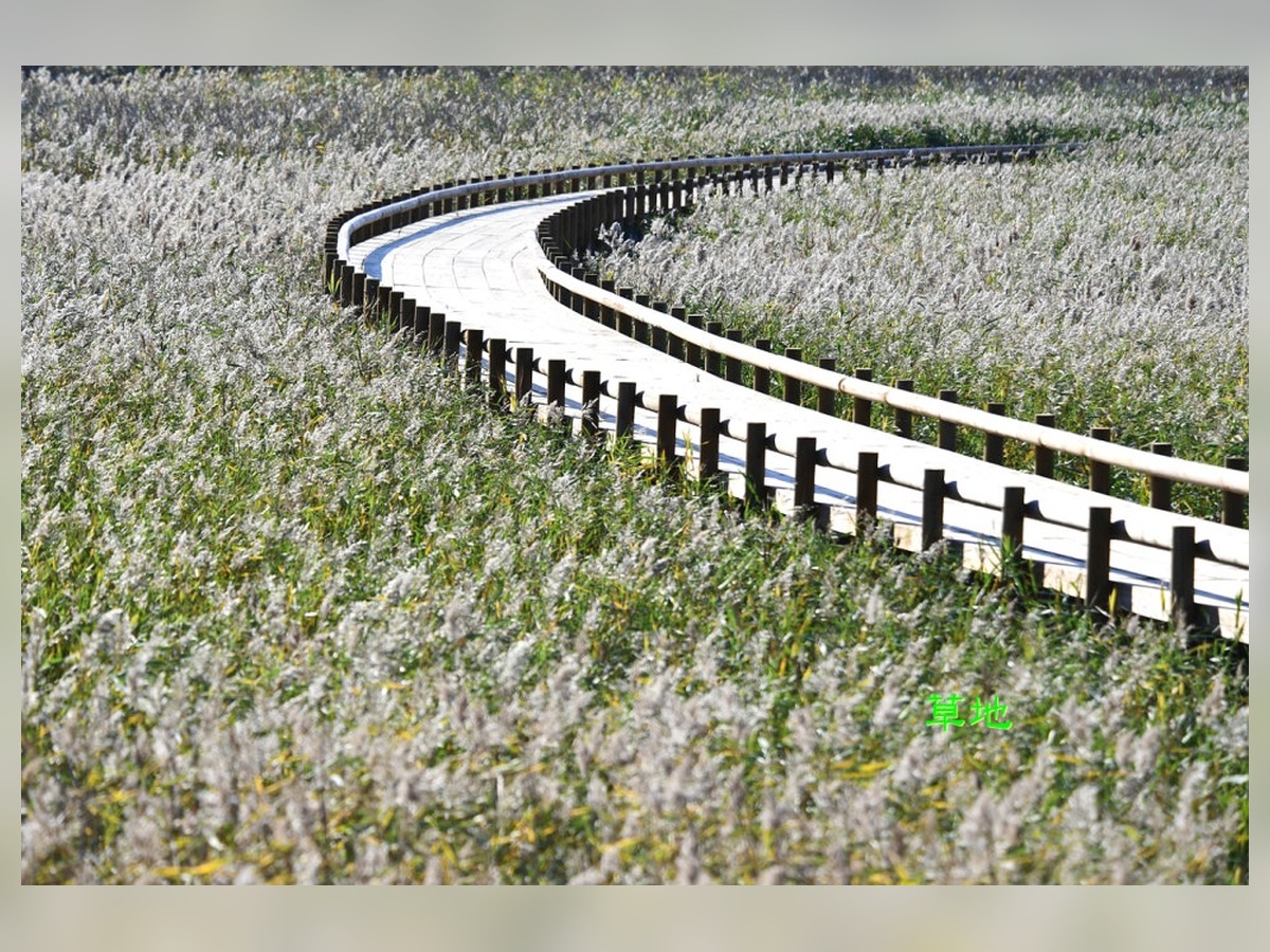
Beolgye Ecological Park
Beolgyo Ecological Park
In Beolgyo Ecological Park, incorporate walking paths and clusters of reeds while showing the direction in which Beolgyocheon flows into the tidal flats, thus representing the estuary ecosystem. Turning on grid lines and aligning horizontal and vertical lines will help maintain stable forms of architecture and pathways. Recommended times are just after the facilities open when natural light is abundant. On-site, avoid blocking the movement of residents and merchants, and confirm any intentions to photograph if people are identifiable. After shooting, record your approach route, light direction, and conditions that influenced the scene such as tide schedules or market days. When returning in other seasons, this will help you find new expressions of the place rather than repeating the same composition.
주소 전남광주통합특별시 보성군 벌교읍 장양리 1434-3
촬영 포인트 산책로와 갈대 군락, 벌교천이 갯벌로 이어지는 방향을 함께 넣어 하구 생태를 표현한다.
추천 시간 시설 개방 직후 자연광이 충분한 시간
현장 팁 주민과 상인의 생활 동선을 막지 않고 인물이 식별되면 촬영 의사를 확인한다.
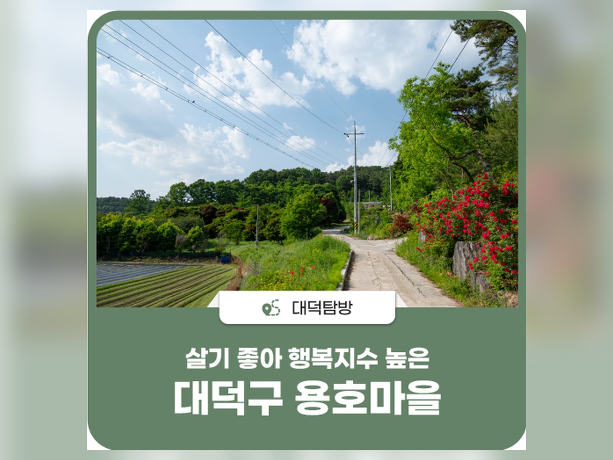
Hodong
In Hodong, capture the rural emptiness of eastern Beolgyo by layering the village fields, tidal flats, and low mountain ridges. Stepping back from the background will reveal the scale of the location without obstructing the lines of the landscape. Recommended times are late afternoons when shadows are elongated. On-site, monitor weather changes and refrain from entering agricultural or private land by sticking to walking paths and embankments. After shooting, document your approach route, light direction, and other conditions that affected the scene, such as tide schedules or market days. When you revisit during other seasons, this will assist in uncovering new expressions of the place without repeating the same composition.
주소 전남광주통합특별시 보성군 벌교읍 호동리
촬영 포인트 마을 들판과 갯벌, 낮은 산 능선을 층으로 나눠 벌교 동쪽 농어촌의 여백을 담는다.
추천 시간 그림자가 길어지는 늦은 오후
현장 팁 산책로와 둑길에서는 농경지·사유지에 들어가지 않고 기상 변화를 살핀다.
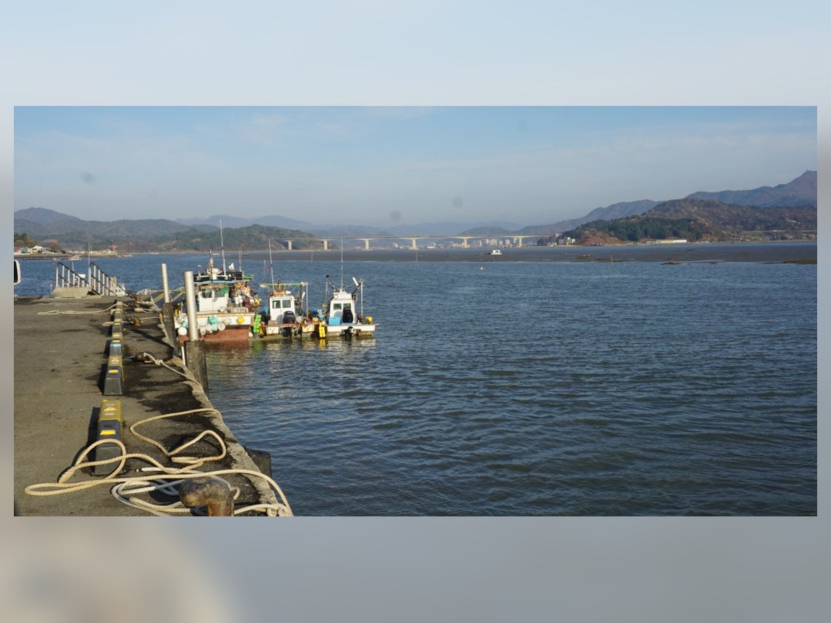
Sangjin Port
At Sangjin Port, you can document the daily life of the port by overlapping the small pier, fishing boats, and the coastline of Jangam-ri. Trying compositions from both frontal and diagonal angles will help convey the depth of the space most naturally. Recommended times are from one hour before sunset to shortly after the sun has set. On-site, check parking and public transport times, and ensure that your tripod does not block entrances or pedestrian paths. After photographing, record your approach route, light direction, and conditions that affected the scene, such as tide schedules or market days. When you return in other seasons, this will assist in discovering new expressions of the place without repeating the same composition.
주소 전남광주통합특별시 보성군 벌교읍 장암리
촬영 포인트 상진항의 작은 선착장과 어선, 장암리 해안을 겹쳐 생활 포구의 일상을 기록한다.
추천 시간 일몰 한 시간 전부터 해가 진 직후
현장 팁 주차와 대중교통 시간을 확인하고 삼각대로 출입구와 보행로를 막지 않는다.
Beolgyo Bridge
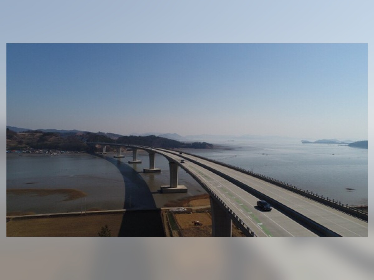
At Beolgyo Bridge, arrange the diagonal lines of the bridge, the mouth of Beolgyocheon, and the fields to depict the boundary connecting the town and the tidal flats. If the light is strong, expose for the bright areas and subtly adjust the shadow colors. Recommended times are just after the rain stops when the colors of rocks and greenery are vivid. On-site, check the ferry and work schedules for the islands and ports and do not touch fishing gear or boats. After shooting, document your approach route, light direction, and conditions that influenced the scene, such as tide schedules or market days. When you revisit during other seasons, this will assist in uncovering new expressions of the place without repeating the same composition.
주소 전남광주통합특별시 보성군 벌교읍 회정리 819
촬영 포인트 교량의 사선과 벌교천 하구, 들판을 넓게 배치해 읍내와 갯벌을 잇는 경계를 보여준다.
추천 시간 비가 그친 뒤 돌과 초록의 색이 선명한 시간
현장 팁 섬과 포구는 배편·작업 시간을 확인하고 어구와 선박에 손대지 않는다.
Daepo
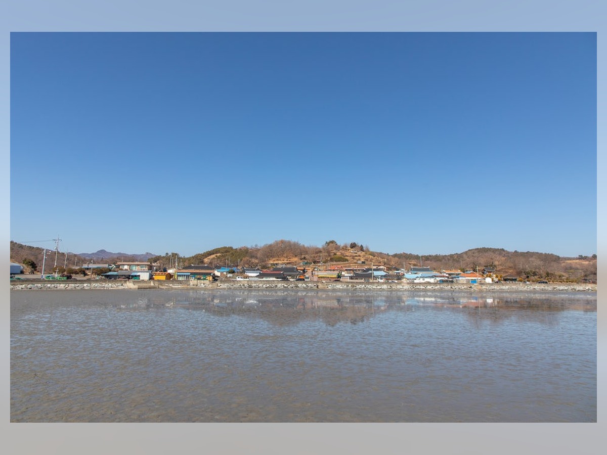
In Daepo, include the village road of Daepo-ri and the rice fields, along with the horizontal line towards Yeojaman to capture the atmosphere of the southern rural coast. It’s helpful to first locate objects to serve as the foreground before slowly adjusting the positions overlapping with the background. Recommended times are bright days when market schedules, train times, or events are confirmed. On-site, use well-lit official walking paths at night and do not stand outside railings or on the edges of rivers. After shooting, document your approach route, light direction, and conditions affecting the scene, such as tide schedules or market days. When returning in other seasons, this will assist in finding new expressions of the place without repeating the same composition.
주소 전남광주통합특별시 보성군 벌교읍 대포리
촬영 포인트 대포리 마을길과 논, 여자만 방향 수평선을 함께 넣어 남쪽 농촌 해안의 분위기를 담는다.
추천 시간 장날·열차 시간·행사를 확인한 밝은 낮
현장 팁 야간에는 밝은 공식 보행로를 이용하고 난간 밖이나 하천 가장자리에 서지 않는다.
Jangdo
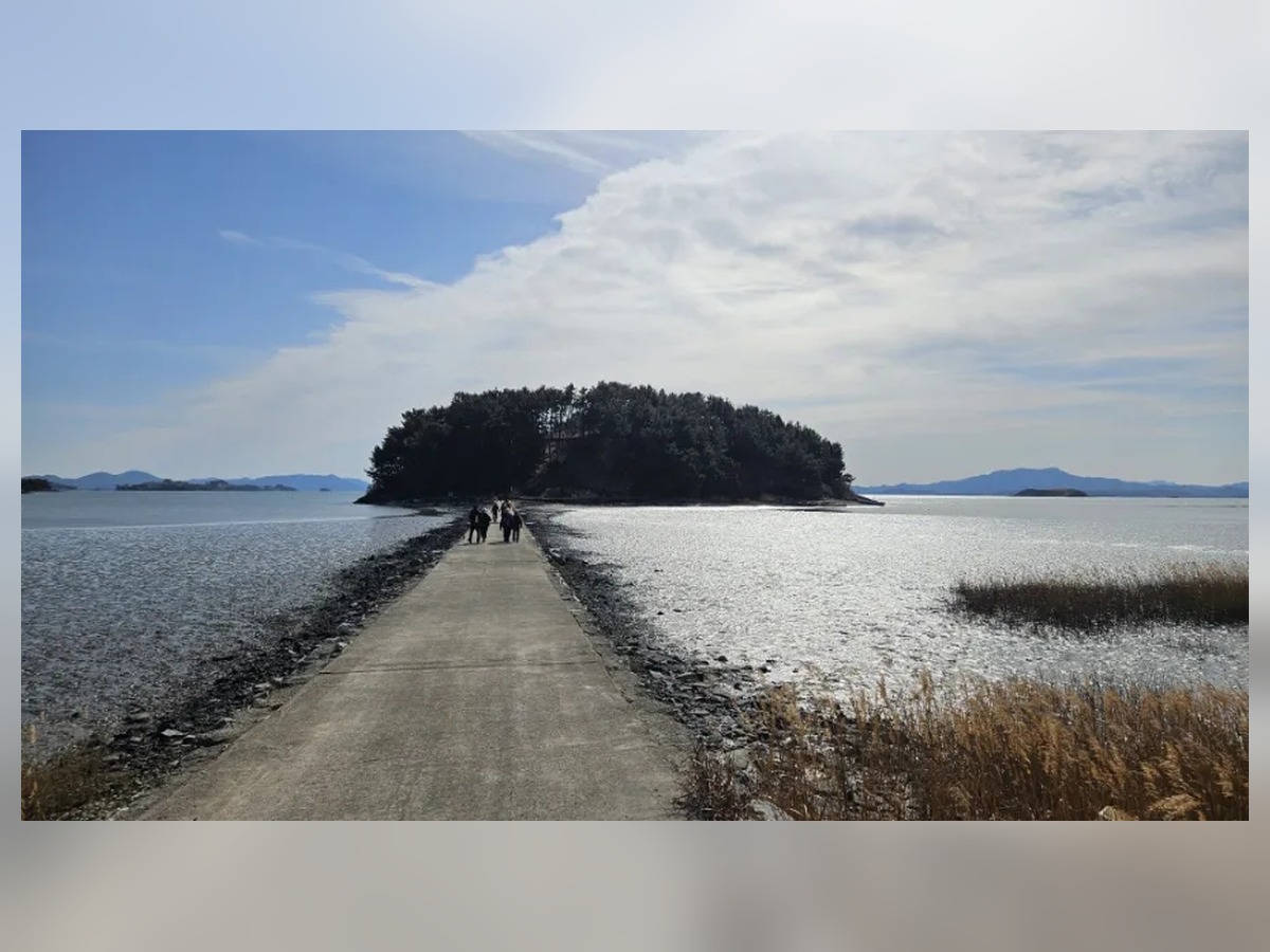
In Jangdo, capture the low roofs of the island, tidal flats, and the direction of the pier to express the sense of isolation and life in the Yeojaman island village. Alternating between eye-level and low perspectives can convey depth in roads and structures differently. Recommended times are mornings or afternoons after confirming tide schedules and weather conditions. On-site, check the operational hours and internal photography regulations of literary and cultural spaces. After shooting, document your approach route, light direction, and conditions that influenced the scene, such as tide schedules or market days. When returning in other seasons, this will assist in discovering new expressions of the place without repeating the same composition.
주소 전남광주통합특별시 보성군 벌교읍 장도리
촬영 포인트 섬의 낮은 지붕과 갯벌, 선착장 방향을 넓게 담아 여자만 섬마을의 고립감과 생활감을 표현한다.
추천 시간 물때와 기상을 확인한 오전 또는 오후
현장 팁 문학·문화 공간은 운영시간과 내부 촬영 규정을 현장에서 확인한다.
Madongji
In Madongji, capture the reflections on the surface of the reservoir, embankments, and the surrounding agricultural land, documenting the quiet waterfront on the west side of Beolgyo. Adding sign markers and photos of your approach route to typical landscapes serves as useful records for future visits. Recommended times are early evenings after checking the returning route. On-site, stay clear of car roads, rails, and restricted areas on roads and railways. After shooting, document your approach route, light direction, and conditions influencing the scene, such as tide schedules or market days. When returning in other seasons, this will assist in finding new expressions of the place without repeating the same composition.
주소 전남광주통합특별시 보성군 벌교읍 마동리 141
촬영 포인트 저수지 수면 반영과 둑, 주변 농경지를 층으로 나눠 벌교 서쪽의 조용한 물가를 기록한다.
추천 시간 귀가 동선을 확인한 초저녁
현장 팁 도로와 철도에서는 차도·선로·통제 구역에 들어가지 않고 안전선을 지킨다.
Tidal flat photos can better capture Beolgyo's living environment by including the curves of waterways, reeds, embankments, and village rooftops, rather than just a wide horizon. During high tide, focus on reflections and water surfaces, and during low tide, capture the patterns of tidal grooves and mud. The fishing boats at the port and the low ridges of the islands also help explain the scale of the space.
The ecological park, Beolgyo Bridge, and tidal flat experience sites are located southeast of the town, while Hodong, Sangjin Port, Daepo, and Jangdo extend further south and east, requiring travel time. Consider the speed of outgoing water and the route back, and do not force your way into the tidal flat. When visiting Jangdo, verify the ferry schedule and respect the private facilities of the port and island. Checking the latest operational information and weather before your visit will help you find time for good compositions on-site.
The ecological park, Beolgyo Bridge, and tidal flat experience sites are located southeast of the town, while Hodong, Sangjin Port, Daepo, and Jangdo extend further south and east, requiring travel time. Consider the speed of outgoing water and the route back, and do not force your way into the tidal flat. When visiting Jangdo, verify the ferry schedule and respect the private facilities of the port and island. Checking the latest operational information and weather before your visit will help you find time for good compositions on-site.
At a glance
8 items
Locations at a glance
8 places
As part of the Coupang Partners program, this post may earn a commission from qualifying purchases.
Comments 0
Log in to leave a comment.
Be the first to comment.
How about these lists?


You might also like




🎲
Not ready to stop here?
Wondering what to read next is the biggest waste of time.
Let the dice decide — you won't know what pops up until you roll.
If you don't press it… won't you wonder forever? 👀